Near Barnwell in Barnwell County, South Carolina — The American South (South Atlantic)
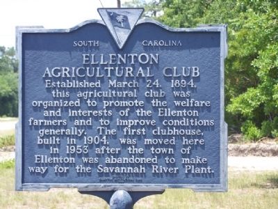
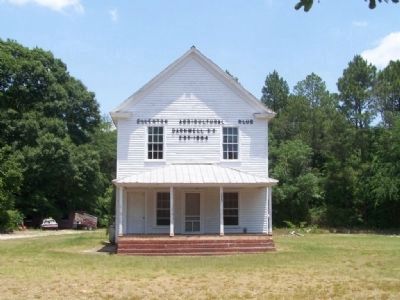
Ellenton Agricultural Club
Erected 1980 by Ellenton Agricultural Club. (Marker Number 6-2F.)
Topics. This historical marker is listed in these topic lists: Agriculture • Fraternal or Sororal Organizations. A significant historical date for this entry is March 24, 1829.
Location. 33° 14.484′ N, 81° 25.428′ W. Marker is near Barnwell, South Carolina, in Barnwell County. Marker is on Dunbarton Boulevard (State Highway 64), on the right when traveling west. Touch for map. Marker is at or near this postal address: 13260 Dunbarton Blvd, Barnwell SC 29812, United States of America. Touch for directions.
Other nearby markers. At least 8 other markers are within 4 miles of this marker, measured as the crow flies. Town of Ellenton (within shouting distance of this marker); Barnwell School District #45 KIA Monument (approx. 2.9 miles away); Barnwell Army Airfield (approx. 2.9 miles away); "The Jefferson Airplane" (approx. 2.9 miles away); Red Hill At Turkey Creek (approx. 3.2 miles away); Fuller Park (approx. 3.2 miles away); Barnwell Baptist Church Cemetery (approx. 3.3 miles away); Calhoun Park (approx. 3.4 miles away). Touch for a list and map of all markers in Barnwell.
Also see . . . Wikipedia entry for the Savannah River Site. The site was built during the 1950s to refine nuclear materials for deployment in nuclear weapons. (Submitted on July 1, 2008, by Mike Stroud of Bluffton, South Carolina.)
Credits. This page was last revised on June 16, 2016. It was originally submitted on July 1, 2008, by Mike Stroud of Bluffton, South Carolina. This page has been viewed 1,349 times since then and 37 times this year. Photos: 1, 2. submitted on July 1, 2008, by Mike Stroud of Bluffton, South Carolina. • Kevin W. was the editor who published this page.

