Glencoe in Lincoln County, New Mexico — The American Mountains (Southwest)
John H. Tunstall Murder Site
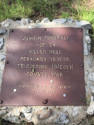
Photographed by Louis Davis, August 9, 2015
1. John H. Tunstall Murder Site Marker
Erected 1978 by Lincoln County Historical Society.
Topics. This historical marker is listed in this topic list: Law Enforcement. A significant historical date for this entry is February 18, 1878.
Location. 33° 21.834′ N, 105° 26.168′ W. Marker is in Glencoe, New Mexico, in Lincoln County. It can be reached from Forest Road FS9019D. Located approximately 4 miles off of US 70. See directions below. Touch for map. Marker is in this post office area: Glencoe NM 88324, United States of America. Touch for directions.

Regionally, this marker is in the Pecos Valley. It is also in the American Southwest. Globally, it is in North America, the Western Hemisphere, the Western World, and the Anglosphere. Historically, it finds itself in what was once New Spain, the Comanchería, and the Republic of Texas.
Other nearby markers. At least 8 other markers are within 10 miles of this marker, measured as the crow flies: Lincoln National Forest (here, next to this marker); John H. Tunstall (approx. 3.2 miles away); San Patricio (approx. 7.1 miles away); Old Dowlin Mill
this page online
More about this marker. The road to get to the Tunstall Kill Site is very rocky. It's not recommended you attempt the drive in a low clearance vehicle, however a 4WD is not necessary.
As of August 2015, Google Maps incorrectly shows the location of FS 9019D. FS 9019D is actually about 100 yards east of the location shown on Google Maps (closer to the bend in FS 443).
Regarding John H. Tunstall Murder Site. Directions:
1. From US 70 turn south onto Glencoe Loop (US 70 Frontage Road).
2. From Glencoe Loop turn south onto Coe Canyon Road.
3. Take Coe Canyon Road until you come to the fork at Tunstall Canyon Road.
4. Take the left leg of the fork which will become Forest Road 443.
5. Drive south down Forest Road 443 for approximately 4 miles (always veer right -- dont take any roads that fork off to the left).
6. Stop at marker 9019D and park (The marker is easy to miss so pay close attention).
7.
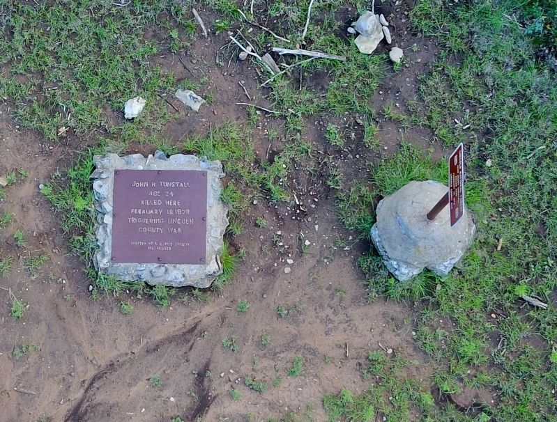
Photographed by Brandon Mason, August 12, 2017
2. John H. Tunstall Murder Site Marker
8. Walk North 408.3 yards along the jeep trail to a tree stump on the left side of the trail with a red arrow painted on it pointing straight ahead. The paint is faded and blends into scenery.
9. Walk West 79.4 yards to the marker.
Also see . . . Start of the Lincoln County Wars. PBS.org's page on the start of the Lincoln County Wars: ...In 1877, an Englishman named John Tunstall came to town to create competition for the local monopoly that owned the main store and had a corner on the lucrative contracts to deliver cattle to the military….History has revealed in his letters home that he planned to put his competition out of business and then create a monopoly of his own. Tunstall never had the opportunity, since he grossly underestimated the ruthlessness of the lawless West…. (Submitted on August 12, 2015.)
Additional commentary.
1. Visited the site Sept 2022
The road wasn't too bad. Some large stones to navigate around, but a Subaru Impreza made it through okay. Found the road marker easily enough and then walked down the hill. The path was completely washed out gullies,
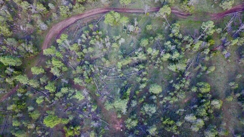
Photographed by Brandon Mason
3. John H. Tunstall Murder Site Marker
An aerial view including location references: downed trees, rocks and road bends.
We could not find the "tree stump with red paint" on it and went too far. Criss-crossed through the woods trying to find the location because we knew which side of the road was the correct side. Found the marker. It's still there.
To mark the spot for the trail for others to find, I found as many big tree branches that I could lug around and made pile of them, which I hope the next visitor going to pay their respects will notice and think “Hey! Someone put these logs here for you to notice. The path is this way!”
Well worth the trip. Lovely hike and adventure.
— Submitted January 12, 2023, by Jesse friedman of Bridgeport, Connecticut.
Additional keywords. Billy the Kid, Lincoln County War
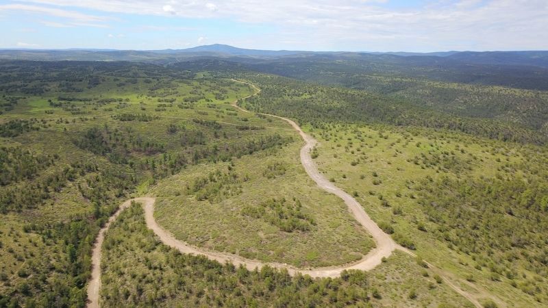
Photographed by Brandon Mason, August 12, 2017
4. John H. Tunstall Murder Site Marker
Even if you can't see it from the sky, you'll know this switchback when you drive up it. I took a subcompact car all the way, any reasonable vehicle can make it. 8/12/17 trail hint: if you encounter a giant mud puddle just past the switchback, go left around it through the bushes, there is now a path. When you turn onto Coe Canyon Road, reset your trip odometer andgo 4.2 miles. The switchback is about halfway.
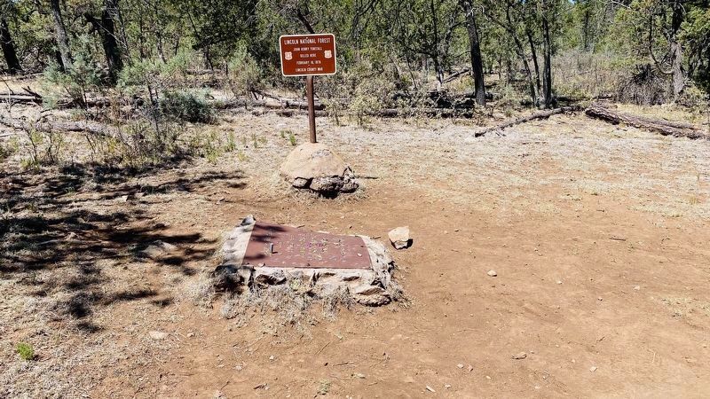
Photographed by Heinz Landeck, May 4, 2020
5. John H. Tunstall Murder Site Marker
At the actual murder site. The last half mile is only for 4X4 vehicles. I only have RWD Suburban which is a bit higher but I would never try this last stretch. It is a wonderful walk and I highly suggest taking this walk and enjoy the scenery and fresh air.
Credits. This page was last revised on February 14, 2026. It was originally submitted on August 12, 2015, by Louis Davis of Austin, Texas. This page has been viewed 18,408 times since then and 1,185 times this year. Photos: 1. submitted on August 12, 2015, by Louis Davis of Austin, Texas. 2, 3, 4. submitted on August 13, 2017, by Brandon Mason of Olton, Texas. 5. submitted on May 4, 2020, by Heinz Landeck of El Paso, Texas. • Andrew Ruppenstein was the editor who published this page.
