
Near Van in Van Zandt County, Texas — The American South (West South Central)
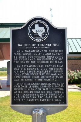
Battle of the Neches
(Site 15 Miles Southeast)
Photographed by Duane Hall, August 3, 2015
1. Battle of the Neches Marker
Main engagement of Cherokee War; fought July 15 and 16, 1839, between 800 Indians (including Delawares and Shawnees) and 500 troops of the Republic of Texas.
An extraordinary fact is that David G. Burnet, vice president of the Republic; Albert Sidney Johnston, Secretary of War; and two other high officials took active parts in the fighting.
When killed, Chief Bowles, the aged Cherokee leader, carried a sword given him by Gen. Sam Houston. After the defeat of the tribes, they scattered, thus virtually ending Indian troubles in the settled eastern part of Texas.
Erected 1968 by State Historical Survey Committee. (Marker Number 11380.)
Topics. This historical marker is listed in this topic list: Wars, US Indian. A significant historical date for this entry is July 15, 1784.
Location. 32° 30.826′ N, 95° 41.12′ W. Marker is near Van, Texas, in Van Zandt County. It can be reached from Interstate 20 at milepost 538, on the right when traveling east. Marker is located at a rest area on the I-20 eastbound lanes between Exits 537 and 540; marker can only be accessed from the eastbound lanes of the freeway. Touch for map. Marker is in this post office area: Van TX 75790, United States of America. Touch for directions.

Regionally, this marker is in the American South and in the Piney Woods. Globally, it is in North America, a Gulf of Mexico state, the Western Hemisphere, the Western World, and the Anglosphere. Historically, it finds itself in what was once New Spain, the Republic of Texas, one of the Confederate States of America, and the Antebellum South.
Other nearby markers. At least 8 other markers are within 3 miles of this marker, measured as the crow flies: The Free State of Van Zandt (about 700 feet away, measured in a direct line); Brady P. Gentry (approx. 0.2 miles away); Pure Oil Company Camp (approx.
this page online
Also see . . .
1. Battle of the Neches. From the Texas State Historical Association’s “Handbook of Texas Online”. (Submitted on August 12, 2015.)
2. Battle of the Neches - Wikipedia entry. (Submitted on August 12, 2015.)
Photographed by Duane Hall, August 3, 2015
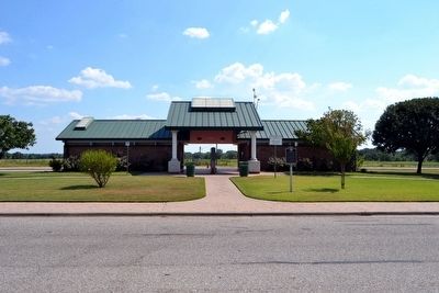
2. Battle of the Neches Marker
Photographed by Duane Hall, August 3, 2015
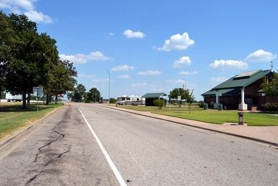
3. I-20 Eastbound Rest Area at Mile Marker 530
Credits. This page was last revised on November 29, 2020. It was originally submitted on August 12, 2015, by Duane Hall of Abilene, Texas. This page has been viewed 2,668 times since then and 211 times this year. Photos: 1, 2, 3. submitted on August 12, 2015, by Duane Hall of Abilene, Texas.
