Saint Jo in Montague County, Texas — The American South (West South Central)
Illinois Bend School
Photographed by QuesterMark, August 9, 2014
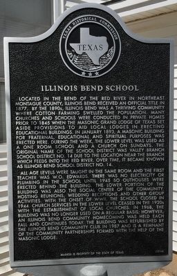
1. Illinois Bend School Texas Historical Marker
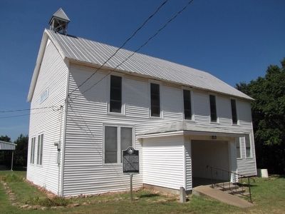
All age levels were taught in the same room and the first teacher was W.O. Edwards. There was no electricity or plumbing i the school until 1945 so outhouses were erected behind the building. The lower portion of the building was also the social center of the community, hosting reunion, wedding receptions and other group activities. With the onset of WWII, the school closed in 1944. Church services in the lower level ceased in the 1920s with the establishment of local churches. In 1968, the building was no longer used on a regular basis; however, an Illinois Bend Community Homecoming was held each fall and continues today. The building was refurbished by the Illinois Bend Community Club in 1987 and is a remnant of the community partnerships formed with the help of the Masonic Lodge.
Erected 2014 by Texas Historical Commission. (Marker Number 17952.)
Topics. This historical marker is listed in these topic lists: Education • Fraternal or Sororal Organizations. A significant historical month for this entry is January 1893.
Location. 33° 52.804′ N,
this page online

Regionally, this marker is in the Prairies & Lakes Region. Globally, it is in North America, a Gulf of Mexico state, the Western Hemisphere, the Western World, and the Anglosphere. Historically, it finds itself in what was once New Spain, the Comanchería, the Republic of Texas, and one of the Confederate States of America.
Other nearby markers. At least 8 other markers are within 13 miles of this marker, measured as the crow flies: Spanish Fort (approx. 8.7 miles away); Site of the 1759 Taovayo Victory Over Spain (approx. 8.7 miles away); Valley View Baptist Church (approx. 11½ miles away); Orr Community Veterans Memorial (approx. 11.6 miles away in Oklahoma); Head of Elm Cemetery (approx. 12.7 miles away); Town of Saint Jo (approx. 12.8 miles away); Stonewall Saloon (approx. 12.9 miles away); Head of Elm (approx.
Photographed by QuesterMark, August 9, 2014
2. Illinois Bend School and Marker
Credits. This page was last revised on June 16, 2016. It was originally submitted on August 12, 2015, by QuesterMark of Fort Worth, Texas. This page has been viewed 1,543 times since then and 76 times this year. Photos: 1, 2. submitted on August 12, 2015, by QuesterMark of Fort Worth, Texas. • Bernard Fisher was the editor who published this page.
