Key West in Monroe County, Florida — The American South (South Atlantic)
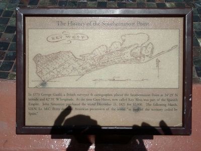
The History of the Southernmost Point
In 1773 George Gauld, a British surveyor & cartographer, placed the Southernmost Point at 24°29'N latitude and 82°35'W longitude. At the time Cayo Hueso, now called Key West, was part of the Spanish Empire. John Simonton purchased the island December 21, 1821 for $2,000. The following March, U.S.N. Lt. M.C. Perry declared American possession of the island "as part of the territory ceded by Spain."
Topics. This historical marker is listed in these topic lists: Exploration • Settlements & Settlers. A significant historical month for this entry is December 1885.
Location. 24° 32.794′ N, 81° 47.851′ W. Marker is in Key West, Florida, in Monroe County. Marker is at the intersection of South Street and Whitehead Street, on the left when traveling south on South Street. Touch for map. Marker is in this post office area: Key West FL 33040, United States of America. Touch for directions.
Other nearby markers. At least 8 other markers are within walking distance of this marker. Southernmost Point (here, next to this marker); The Cable Hut (a few steps from this marker); J. Vining and Florida Curry Harris House (within shouting distance of this marker); Eduardo H. Gato House (about 400 feet away, measured in a direct line); Southernmost House (about 400 feet away); Casa Cayo Hueso (about 400 feet away); Semper Fidelis (about 500 feet away); Emma Carrero Cates Pier at Southern Beach (about 600 feet away). Touch for a list and map of all markers in Key West.

Photographed By Richard Denney
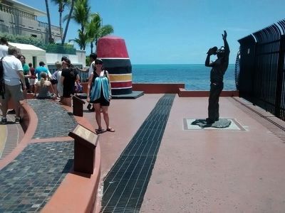
3. Southernmost Point Buoy
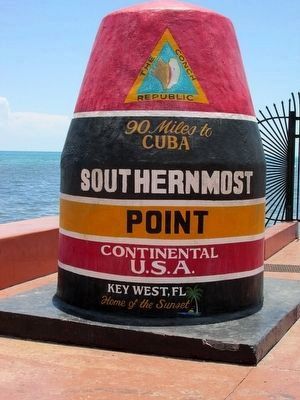
The southernmost point was originally marked with a sign, which was often stolen. In response the city of Key West erected the now famous concrete buoy in 1983 and it has become one of the most visited and photographed attractions in Key West.
Credits. This page was last revised on January 26, 2018. It was originally submitted on August 19, 2015, by Richard Denney of Austin, Texas. This page has been viewed 959 times since then and 74 times this year. Photos: 1, 2, 3. submitted on August 19, 2015, by Richard Denney of Austin, Texas. • Bernard Fisher was the editor who published this page.

