Near Fort Oglethorpe in Catoosa County, Georgia — The American South (South Atlantic)
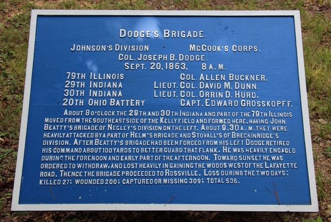
Dodge's Brigade
Johnson's Division
— McCook's Corps —
Johnson's Division, McCook's Corps.
Colonel Joseph B. Dodge.
September 20, 1863, 8 a.m.
79th Illinois - Colonel Allen Buckner.
29th Indiana - Lieutenant Colonel David M. Dunn.
30th Indiana - Lieutenant Colonel Orrin D. Hurd.
20th Ohio Battery - Captain Edward Grosskopff.
About 8 o'clock the 29th and 30th Indiana and part of the 79th Illinois moved from the southeast side of the Kelly field and formed here, having John Beatty's brigade of Negley's division on the left. About 9:30 a.m. they were heavily attacked by a part of Helm's brigade and Stovall's of Breckinridge's division. After Beatty's brigade had been forced from his left Dodge retired his command about 100 yards to better guard that flank. He was heavily engaged during the forenoon and part of the afternoon. Toward sunset he was ordered to withdraw, and lost heavily in gaining the woods west of the Lafayette road. Thence the brigade proceeded to Rossville. Loss during the two days: killed 27; wounded 200; captured or missing 309; total 536.
Erected 1890 by the Chickamauga and Chattanooga National Military Park Commission. (Marker Number MT-587.)
Topics. This historical marker is listed in this topic list: War, US Civil . A significant historical date for this entry is September 20, 1863.
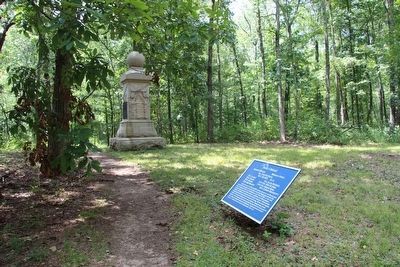
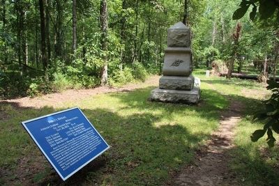
Location. 34° 56.044′ N, 85° 15.43′ W. Marker is near Fort Oglethorpe, Georgia, in Catoosa County. Marker can be reached from Battleline Road south of Alexander Bridge Road, on the right when traveling south. This tablet is located in the national park that preserves the site of the Chickamauga Battlefield, The tablet is located on a park hiking trail that proceeds eastward, towards the Lafayette Road, into the woods, from the parking area located at the northern end of Battleline Road. Touch for map. Marker is in this post office area: Fort Oglethorpe GA 30742, United States of America. Touch for directions.
Other nearby markers. At least 8 other markers are within walking distance of this marker. 29th Indiana Infantry (a few steps from this marker); 30th Indiana Infantry (a few steps from this marker); 8th Kentucky Infantry Regiment (US Volunteers) (a few steps from this marker); 79th Illinois Infantry (a few steps from this marker); 51st Ohio Infantry (within shouting distance of this marker); 84th Illinois Infantry (within shouting distance of this marker); Barnes' Brigade (about 300 feet away, measured in a direct line); 99th Ohio Infantry (about 400 feet away). Touch for a list and map of all markers in Fort Oglethorpe.
More about this marker. I used the "Chickamauga Battlefield" map, that I purchased at the Chickamauga and Chattanooga National Military Park,
Visitor Center, to determine both the marker number for this tablet and the tablet's location in relation to the rest of the park's monuments, markers, and tablets. According to the map it provides the, "numerical listing of all monuments, markers, and tablets on the Chickamauga Battlefield (using the Chick-Chatt NMP Monument Numbering System).”
Credits. This page was last revised on July 3, 2017. It was originally submitted on August 21, 2015, by Dale K. Benington of Toledo, Ohio. This page has been viewed 320 times since then and 12 times this year. Photos: 1, 2, 3. submitted on August 23, 2015, by Dale K. Benington of Toledo, Ohio.


