Sunbury in Northumberland County, Pennsylvania — The American Northeast (Mid-Atlantic)
Sunbury
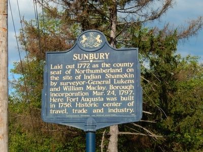
Photographed by Beverly Pfingsten, August 22, 2015
1. Sunbury Marker
Topics. This historical marker is listed in this topic list: Political Subdivisions. A significant historical year for this entry is 1772.
Location. 40° 51.553′ N, 76° 46.519′ W. Marker is in Sunbury, Pennsylvania, in Northumberland County. It is on Highland Ave. (Pennsylvania Route 61), on the right when traveling west. Marker is on the east side of the bridge. Touch for map. Marker is in this post office area: Sunbury PA 17801, United States of America. Touch for directions.

Regionally, this marker is in Pennsylvania’s Anthracite Coal Region and in the Susquehanna Valley. It is also in the American Northeast, in the Mid-Atlantic, in Appalachia, and specifically in Northern Appalachia. Globally, it is in North America, the Western Hemisphere, the Western World, and the Anglosphere. Historically, it finds itself in what was once the Haudenosaunee (Iroquois) Confederacy
this page online
Other nearby markers. At least 8 other markers are within 2 miles of this marker, measured as the crow flies: The Hotel Edison (approx. 0.8 miles away); Northumberland Civil War Memorial (approx. one mile away); For Those Who Served (approx. one mile away); Lorenzo Da Ponte (1749-1838) (approx. one mile away); Sunbury War Memorials (approx. one mile away); Erected to the Memory of the World War Heroes (approx. one mile away); Northumberland County (approx. one mile away); Beck House (approx. 1.1 miles away). Touch for a list and map of all markers in Sunbury.
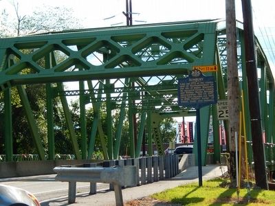
Photographed by Beverly Pfingsten, August 22, 2015
2. Sunbury Marker
Credits. This page was last revised on June 16, 2016. It was originally submitted on August 25, 2015, by Bill Pfingsten of Bel Air, Maryland. This page has been viewed 455 times since then and 38 times this year. Photos: 1, 2. submitted on August 25, 2015, by Bill Pfingsten of Bel Air, Maryland.
