Near Fort Bidwell in Modoc County, California — The American West (Pacific Coastal)
The Applegate Trail
Fandango Pass
Inscription.
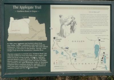
In 1846, Jesse Applegate and fourteen others from near Dallas, Oregon, established a trail south from the Willamette Valley and east to Fort Hall. This route offered emigrants an alternative to the perilous "last leg" over the Oregon Trail down the treacherous Colombia River.
The first emigrants to trek the new "Southern Route" left with the trailblazers from Fort Hall in early August 1846. With Levi Scott acting as guide, while Jesse Applegate traveled ahead to mark the route, the hardy emigrants blazed a wagon trail through nearly 500 miles of wilderness arriving in the upper Willamette Valley in November. Emigrants travel continued along the Applegate Trail in later years and contributed greatly to the settlement of southern Oregon and the Willamette Valley.
Beginning in 1846 travelers on the Applegate Trail bound for Oregon crossed the Warner Mountains through this pass. This pass was also trekked by the "forty-niners" during the California gold rush on a route pioneered by Peter Lassen in 1848. Early travelers believed (incorrectly) that this ridge was part of the Sierra Nevada Range and thought that once crossed the trip was almost over. Cresting these mountains was cause for celebration - including a popular 19th century dance called the Fandango.
Cross over a mountain, the ascent about 2 miles and quite steep. Travel 9 miles and camp in a beautiful plain surrounded by stately pine and cedar. Excellent for our stock. - Virgil K. Pringle, September 20, 1846
Topics and series. This historical marker is listed in these topic lists: Roads & Vehicles • Settlements & Settlers. In addition, it is included in the Applegate Trail series list. A significant historical date for this entry is September 20, 1846.
Location. 41° 48.096′ N, 120° 12.336′ W. Marker is near Fort Bidwell, California, in Modoc County. Marker is on Fandango Pass Road, on the left when traveling west. Touch for map. Marker is in this post office area: Fort Bidwell CA 96112, United States of America. Touch for directions.
Other nearby markers. At least 8 other markers are within 10 miles of this marker, measured as the crow flies. The Applegate-Lassen Trail (here, next to this marker); Applegate Trail - Fandango Pass Descent (within shouting distance of this marker); Applegate Trail - Fandango Pass Ascent (approx. 0.4 miles away); Fort Bidwell Military Post (approx. 4.8 miles away); Applegate Trail - Through the Forest (approx. 5.4 miles away); Applegate Trail - Descent to Lassen Creek (approx. 6.9 miles away); Applegate Trail - Descent to Goose Lake (approx. 8.4 miles away); Applegate Trail - New Road to Yreka (approx. 10 miles away). Touch for a list and map of all markers in Fort Bidwell.
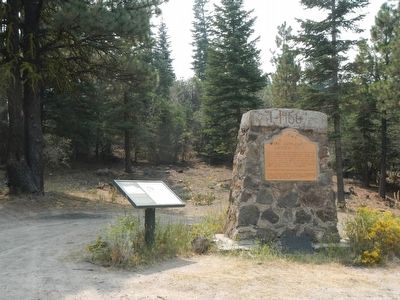
More about this marker. This marker is located at the summit of Fandango Pass.
Also see . . .
1. Applegate Trail - Emigrant Trails West, Inc. Seeking a safer and more direct wagon route to the Willamette Valley in Oregon, Jesse Applegate and Levi Scott led an exploring party in 1846 to the California Trail on the Humboldt River near what was later to be known as Lassen Meadows... From there they guided a wagon train across the Black Rock Desert, through High Rock Canyon, to Goose Lake, and then westward to Oregon and its Willamette Valley. (Submitted on August 29, 2015, by Barry Swackhamer of Brentwood, California.)
2. Uncle Pete's Trail - Fandango Pass Road - Church of the Open Road. The Fandango Pass portion was the eastern end of this cut-off, named, some say, because men, in crossing this pass late one season found themselves having to dance a fandango at night in order to warm bodies against the freezing October nights. (Submitted on August 29, 2015, by Barry Swackhamer of Brentwood, California.)
Credits. This page was last revised on June 16, 2016. It was originally submitted on August 29, 2015, by Barry Swackhamer of Brentwood, California. This page has been viewed 514 times since then and 16 times this year. Photos: 1, 2. submitted on August 29, 2015, by Barry Swackhamer of Brentwood, California.

