Marker Logo HMdb.org THE HISTORICAL
MARKER DATABASE
“Bite-Size Bits of Local, National, and Global History”
Myers Flat in Humboldt County, California — The American West (Pacific Coastal)
 

The Shrine Tree


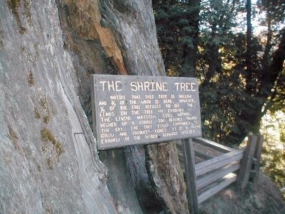
The Shrine Tree Marker image. Click for full size.
Photographed By Don Morfe, October 8, 2006
1. The Shrine Tree Marker
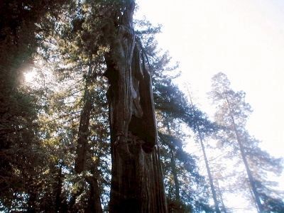
Inscription. Notice that this tree is hollow and 3/4 of the wood is dead. However, 1/4 of the tree refuses to die. The limbs on the tree are evidence of the living material still within. Higher up a double top reaches toward the sky. The tree itself continues to grow and produces cones. It is a prime example of the hardy redwood species.
 
Topics. This historical marker is listed in this topic list: Horticulture & Forestry.
 
Location. 40° 16.092′ N, 123° 52.506′ W. Marker is in Myers Flat, California, in Humboldt County. Touch for map. Marker is at or near this postal address: 13078 Avenue of the Giants, Myers Flat CA 95554, United States of America. Touch for directions.
 
Other nearby markers. At least 8 other markers are within 7 miles of this marker, measured as the crow flies. Colonel Raynal C. Bolling (approx. 1.4 miles away); Old Giant Redwood Tree (approx. 3.2 miles away); Redwood Time-ring (approx. 3.3 miles away); Mother Nature Cannot Be Tamed (approx. 4.8 miles away); Humboldt Redwoods State Park (approx. 4.8 miles away); Laura Perrott Mahan & James P. Mahan (approx. 6.1 miles away); The Tangled Roots of Founders Grove (approx. 6.4 miles away); "Ltcuntadun" (approx. 6.6 miles away). Touch for a list and map of all markers in Myers Flat.
 
Paid Advertisement
Click on the ad for more information.
Please report objectionable advertising to the Editor.
Click or scan to see
this page online
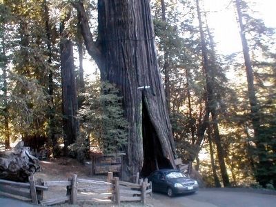
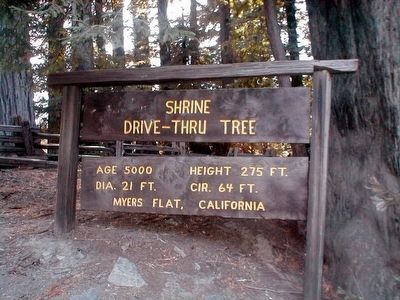
Shrine Drive-Thru Tree image. Click for full size.
Photographed By Don Morfe, October 8, 2006
2. Shrine Drive-Thru Tree
Age 5,000; height 275 feet; dia. 21 ft.; cir. 64 ft; Myers Flat, California
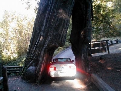
The Shrine Tree-Car entering image. Click for full size.
Photographed By Don Morfe, October 8, 2006
3. The Shrine Tree-Car entering
The Shrine Tree-Car leaving image. Click for full size.
Photographed By Don Morfe, October 8, 2006
4. The Shrine Tree-Car leaving
The top of the Shrine Tree image. Click for full size.
Photographed By Don Morfe, October 8, 2006
5. The top of the Shrine Tree
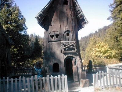
The Tree House image. Click for full size.
Photographed By Don Morfe, October 8, 2006
6. The Tree House
 
 
Credits. This page was last revised on June 16, 2016. It was originally submitted on August 29, 2015, by Don Morfe of Baltimore, Maryland. This page has been viewed 464 times since then and 25 times this year. Photos:   1, 2, 3, 4, 5, 6. submitted on August 29, 2015, by Don Morfe of Baltimore, Maryland. • Andrew Ruppenstein was the editor who published this page.
Share this page.  
Share on Tumblr
m=87848

CeraNet Cloud Computing sponsors the Historical Marker Database.
This website earns income from purchases you make after using our links to Amazon.com. We appreciate your support.
Paid Advertisement
Apr. 19, 2024