Napoleonville in Assumption Parish, Louisiana — The American South (West South Central)
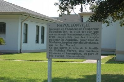
Napoleonville
Ce lac porte le nom de la famille de Nicholas Verret, des Paroisses St-James et Assomption, où père et fils furent Commandants.
English translation:
Named for the Emperor of France, Napoleon. An early travel route, 1730-70, used by the French then Acadians from St. James to the Attakapas Landing on Lake Verret.
Lake was named for Nicholas Verret Family of St. James and Assumption Parishes where father and son served as Commandants.
Erected by Codofil et la Bureau du Tourisme.
Topics. This historical marker is listed in these topic lists: Industry & Commerce • Settlements & Settlers. A significant historical year for this entry is 1730.
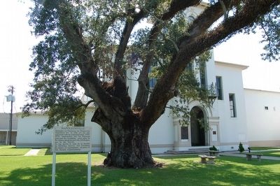
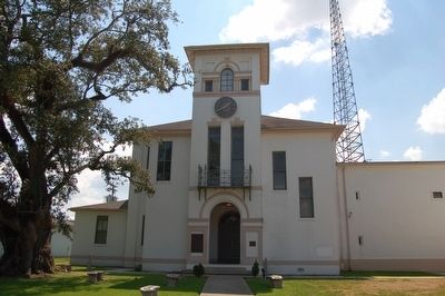
Location. 29° 56.479′ N, 91° 1.458′ W. Marker is in Napoleonville, Louisiana, in Assumption Parish. Marker is at the intersection of State Highway 1 and Franklin Avenue, on the right when traveling south on State Highway 1. On the grounds of the Assumption Parish Court House. Touch for map. Marker is at or near this postal address: 4809 LA-1, Napoleonville LA 70390, United States of America. Touch for directions.
Other nearby markers. At least 8 other markers are within 8 miles of this marker, measured as the crow flies. Assumption Parish WWII Memorial (a few steps from this marker); Great War Memorial (within shouting distance of this marker); Assumption Parish World War II Memorial (within shouting distance of this marker); Christ Episcopal Church (about 600 feet away, measured in a direct line); Madewood Plantation House (approx. 2.1 miles away); Battle Of Georgia Landing (approx. 6.3 miles away); Israel Baptist School / Formerly Baptist Church School (approx. 7.6 miles away); Valenzuela Dans La Fourche (approx. 7.9 miles away). Touch for a list and map of all markers in Napoleonville.
Credits. This page was last revised on December 5, 2016. It was originally submitted on August 29, 2015. This page has been viewed 586 times since then and 34 times this year. Photos: 1, 2, 3. submitted on August 29, 2015. • Bernard Fisher was the editor who published this page.


