Near Worden in Klamath County, Oregon — The American West (Northwest)
Western International History
Applegate Trail
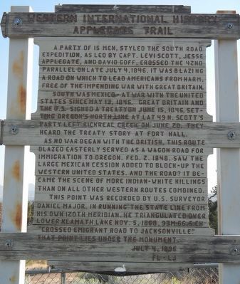
South was Mexico - at war with the United States since May 13, 1846. Great Britain and the U.S. signed a treaty on June 15, 1846, setting Oregon's north line at lat. 49 N. Scott's party left Rickreal Creek on June 20. They heard the treaty story at Fort Hall.
As no war began with the British, this route blazed easterly served as a wagon road for immigration to Oregon. Feb. 2 1848, saw the large Mexican cession added to block-up the western United States. And the road? It became the scene of more Indian-white killings than on all other western routes combined.
This point was recorded by U.S. Surveyor Daniel Major. In running the state line from his own 120th meridian, he triangulated over Lower Klamath Lake Nov. 5, 1868. 93m-66.5ch "crossed emigrant road to Jacksonville." That point lies under the monument.
Erected 1996.
Topics and series. This historical marker is listed in these topic lists: Political Subdivisions • Roads & Vehicles • Settlements & Settlers. In addition, it is included in the Applegate Trail series list. A significant historical date for this entry is July 4, 1846.
Location. 42° 0.203′ N, 121° 53.387′ W. Marker is near Worden, Oregon, in Klamath County. Marker is on U.S. 97. Touch for map. Marker is at or near this postal address: 24800 US Highway 97, Klamath Falls OR 97601, United States of America. Touch for directions.
Other nearby markers. At least 8 other markers are within 9 miles of this marker, measured as the crow flies. Resolving the Oregon Question (a few steps from this marker); Applegate Trail (a few steps from this marker); The 42nd Parallel (a few steps from this marker); a different marker also named Applegate Trail (about 400 feet away, measured in a direct line); Dorris Veterans Memorial (approx. 3.1 miles away in California); South Road - Hot Creek (approx. 5.1 miles away in California); Picard California (approx. 5.1 miles away in California); Bear Valley (approx. 8.6 miles away). Touch for a list and map of all markers in Worden.
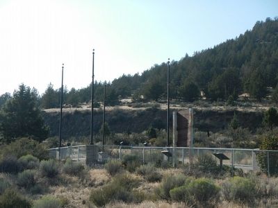
More about this marker. This marker is located at the Francis C. Landrum Historic Wayside.
Additional keywords. boundary
Credits. This page was last revised on June 16, 2016. It was originally submitted on August 31, 2015, by Barry Swackhamer of Brentwood, California. This page has been viewed 309 times since then and 8 times this year. Photos: 1, 2. submitted on August 31, 2015, by Barry Swackhamer of Brentwood, California.

