Near Worden in Klamath County, Oregon — The American West (Northwest)
Applegate Trail
Klamath County
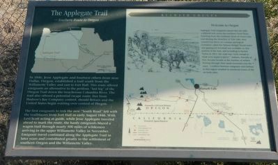
Inscription.
In 1846, Jesse Applegate and fourteen others from near Dallas, Oregon, established a trail south from the Willamette Valley and east to Fort Hall. This route offered emigrants an alternative to the perilous "last leg" over the Oregon Trail down the treacherous Colombia River. The trail also offered a potential escape route, free from Hudson's Bay Company control, should Britain and the United States begin warning over control of Oregon.
The first emigrants to trek the new "Southern Route" left with trailblazers from Fort Hall in early August 1846. With Levi Scott acting as guide, while Jesse Applegate traveled ahead to mark the route, the hardy emigrants blazed a wagon trail through nearly 500 miles of wilderness arriving in the upper Willamette Valley in November. Emigrants travel continued along the Applegate Trail in later years and contributed greatly to the settlement of southern Oregon and the Willamette Valley.
Applegate Trail emigrants passed this site after a difficult trek across the northern Great Basin. Traveling from the southeast shore of Goose Lake and skirting the shoreline of Tule Lake, they crossed Lost River on a unique geological formation called the Natural Bridge. Good water and grazing for livestock was available on this portion of the trail, and according to Rachel Taylor in 1851, the road was "rock enough to break every wagon to pieces." Indians, friendly at first, became hostile as the number of settlers flowing through their lands increased over the years. Conflicts between emigrants and Indians in this region resulted in enormous losses of life on both sides.
Topics and series. This historical marker is listed in these topic lists: Roads & Vehicles • Settlements & Settlers. In addition, it is included in the Applegate Trail series list. A significant historical month for this entry is August 1846.
Location. 42° 0.202′ N, 121° 53.377′ W. Marker is near Worden, Oregon, in Klamath County. Marker can be reached from U.S. 97, on the right when traveling south. Touch for map. Marker is at or near this postal address: 24800 US Highway 97, Klamath Falls OR 97601, United States of America. Touch for directions.
Other nearby markers. At least 8 other markers are within 9 miles of this marker, measured as the crow flies. Western International History (a few steps from this marker); Resolving the Oregon Question (a few steps from this marker); The 42nd Parallel (within shouting distance of this marker); a different marker also named Applegate Trail (about 300 feet away, measured in a direct line); Dorris Veterans Memorial (approx. 3.1 miles away in California);
South Road - Hot Creek (approx. 5.1 miles away in California); Picard California (approx. 5.1 miles away in California); Bear Valley (approx. 8.6 miles away). Touch for a list and map of all markers in Worden.
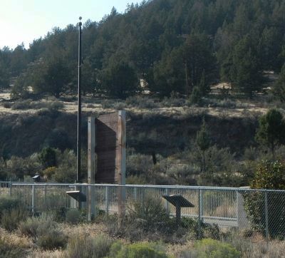
More about this marker. This marker is located at the Francis C. Landrum Historic Wayside.
Credits. This page was last revised on June 16, 2016. It was originally submitted on August 31, 2015, by Barry Swackhamer of Brentwood, California. This page has been viewed 455 times since then and 17 times this year. Photos: 1, 2. submitted on August 31, 2015, by Barry Swackhamer of Brentwood, California.

