Merrimack in Hillsborough County, New Hampshire — The American Northeast (New England)
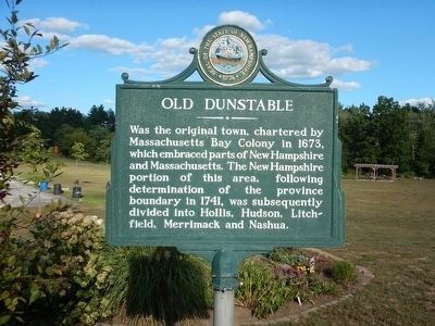
Old Dunstable
Was the original town, chartered by Massachusetts Bay Colony in 1673, which embraced parts of New Hampshire and Massachusetts. The New Hampshire portion of this area, following determination of the province boundary in 1741, was subsequently divided into Hollis, Hudson, Litchfield, Merrimack and Nashua.
Erected by New Hampshire Division of Historical Resources. (Marker Number 029.)
Topics and series. This historical marker is listed in this topic list: Settlements & Settlers. In addition, it is included in the New Hampshire Historical Highway Markers series list. A significant historical year for this entry is 1673.
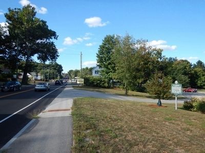
Location. 42° 51.723′ N, 71° 29.601′ W. Marker is in Merrimack, New Hampshire, in Hillsborough County. Marker is on Daniel Webster Highway (U.S. 3) north of Woodbury Street, on the right when traveling north. Touch for map. Marker is in this post office area: Merrimack NH 03054, United States of America. Touch for directions.
Other nearby markers. At least 8 other markers are within 7 miles of this marker, measured as the crow flies. Lowell Memorial Library (approx. 0.3 miles away); War Memorial (approx. 0.4 miles away); Veterans and War Memorial (approx. half a mile away); Matthew Thornton (approx. 1˝ miles away); Historic Homes (approx. 5.1 miles away); Colonel John Goffe (approx. 6˝ miles away); Abbot-Spalding House (approx. 6.8 miles away); Nashua Soldiers and Sailors Monument (approx. 6.8 miles away). Touch for a list and map of all markers in Merrimack.
Credits. This page was last revised on June 16, 2016. It was originally submitted on September 2, 2015, by Kevin Craft of Bedford, Quebec. This page has been viewed 423 times since then and 26 times this year. Photos: 1, 2. submitted on September 2, 2015, by Kevin Craft of Bedford, Quebec.

