Pleasant Hill in Cass County, Missouri — The American Midwest (Upper Plains)
400 Cedar St.
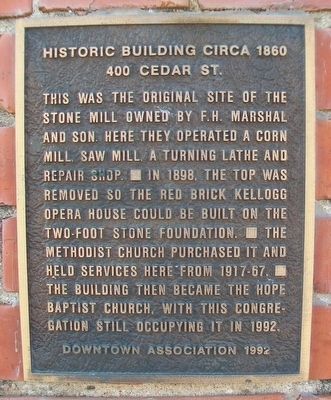
Historic Building circa 1860
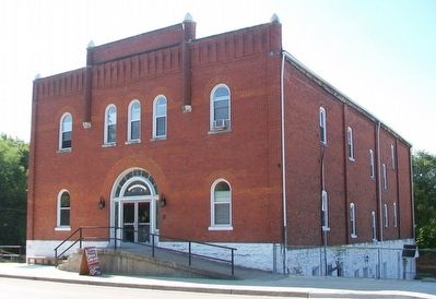
This was the original site of the stone mill owned by F.H. Marshal and Son. Here they operated a corn mill, saw mill, a turning lathe and repair shop. In 1898, the top was removed so the red brick Kellogg Opera House could be built on the two-foot stone foundation. The Methodist Church purchased it and held services here from 1917-67. The building then became the Hope Baptist Church, with this congregation still occupying it in 1992.
Erected 1992 by Pleasant Hill Downtown Association.
Topics and series. This historical marker is listed in these topic lists: Arts, Letters, Music • Churches & Religion • Entertainment • Industry & Commerce. In addition, it is included in the Missouri, Pleasant Hill Downtown Association series list. A significant historical year for this entry is 1898.
Location. 38° 47.184′ N, 94° 16.31′ W. Marker is in Pleasant Hill, Missouri, in Cass County. Marker is at the intersection of Cedar Street and Taylor Street, on the right when traveling east on Cedar Street. Touch for map. Marker is at or near this postal address: 400 Cedar Street, Pleasant Hill MO 64080, United States of America. Touch for directions.
Other nearby markers. At least 8 other markers are within walking distance of this marker. 100 Veterans Parkway (about 400 feet away, measured in a direct line); 110 South Lake Street (about 400 feet away); Pleasant Hill, Missouri (about 500 feet away); Historic Building 1948 (about 500 feet away); Defenders of Freedom Veterans Memorial (about 600 feet away); Col. Hiram Bledsoe (about 700 feet away); The Civil War in Pleasant Hill (about 700 feet away); Missouri Pacific Railroad Depot (about 700 feet away). Touch for a list and map of all markers in Pleasant Hill.
Also see . . . Historic Pleasant Hill MO. (Submitted on September 7, 2015, by William Fischer, Jr. of Scranton, Pennsylvania.)
Credits. This page was last revised on November 25, 2020. It was originally submitted on September 7, 2015, by William Fischer, Jr. of Scranton, Pennsylvania. This page has been viewed 337 times since then and 10 times this year. Photos: 1, 2. submitted on September 7, 2015, by William Fischer, Jr. of Scranton, Pennsylvania.

