Near Relay in Baltimore County, Maryland — The American Northeast (Mid-Atlantic)
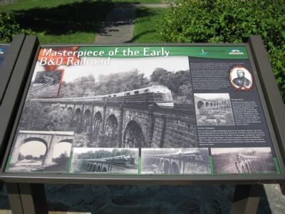
Masterpiece of the Early B&O Railroad
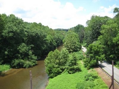
In 1833, B&O engineers sough to build a first-class railroad line with gentle curves and low grades from Baltimore to Washington D.C. Spanning the cavernous Patapsco Valley was a formidable challenge. Benjamin latrobe, Jr. not only met this obstacle, but designed an engineering marvel.
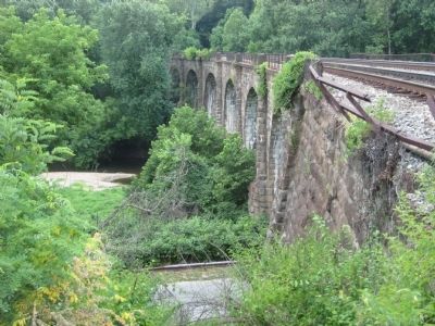
Completed in July 1835, the Thomas Viaduct was among the largest stone-arched bridges in the world. The 704 foot curved bridge is 66 feet hight and connects Relay to Elkridge on eight eliptical arches. Though critics thought it incapable of bearing itw own weight, the viaduct not only carried the first steam locomotives, but also continues to support modern-day trains.
The Real Heroes
Hundreds of immigrant workers built the Thomas Viaduct under the hard-driven direction of John McCartney. Working for low wages and living in improvise shantytowns, the laborers used hand tools, wheelbarrows, primitive pulleys, along with sweat and muscles to hoist 63,000 tons of granit into place. Several workers were killed building the Thomas Viaduct.
Civil War Chokepoint
Prior to 1872, the B&O's Washington Branch was the federal capital's only direct rail and telegraph link with the North. During the Civil War, protecting this connection proved critical to the Union war effort. To discourage Confederate raiders and saboteurs, Union troops began a four-year occupation of Relay and Elkridge in 1861 to protect the railroad. Union General Benjamin F. Butler used the camp at Relay as a staging area for his occupation of Baltimore's Federal Hill, securing the city for the Union.
Erected by Maryland Departing of Natural Resources, Chesapeake Bay Gateways Network.
Topics and series. This historical marker is listed in these topic lists: Bridges & Viaducts • Communications • Industry & Commerce • Railroads & Streetcars • War, US Civil. In addition, it is included in the Baltimore and Ohio Railroad (B&O) series list. A significant historical month for this entry is July 1835.
Location. 39° 13.34′ N, 76° 42.708′ W. Marker is near Relay, Maryland, in Baltimore County. Marker can be reached from the intersection of Washington Boulevard (U.S. 1) and South Street. Marker is within the Patapsco Valley State Park - Avalon area, just in front of the park gate building. Entrance
to PVSP is about 300 feet north of the US 1 - South Street intersection. Touch for map. Marker is in this post office area: Halethorpe MD 21227, United States of America. Touch for directions.
Other nearby markers. At least 8 other markers are within walking distance of this marker. A Rural Vacation Spot (here, next to this marker); During the Civil War (within shouting distance of this marker); The Thomas Viaduct (about 300 feet away, measured in a direct line); The Relay House (about 700 feet away); Elk Ridge Landing (approx. 0.4 miles away); World War II (approx. 0.4 miles away); Great War (approx. half a mile away); Patapsco Valley State Park (approx. half a mile away). Touch for a list and map of all markers in Relay.
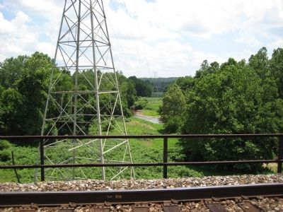
More about this marker. The marker is about 300 feet east of the base of the viaduct. The track level can only be reach by foot from the park roadway. Alternative path to track level is via Lawyers Hill Road, just south of its intersection with Levering Avenue and River Road in Elkridge, Maryland. A Thomas Viaduct obelisk marker is on the north side of the viaduct with can be reached by a short walk from the intersection of Railroad and Viaduct avenues in Relay, Maryland.
Credits. This page was last revised on June 16, 2016. It was originally submitted on July 5, 2008, by F. Robby of Baltimore, Maryland. This page has been viewed 4,021 times since then and 129 times this year. Photos: 1, 2, 3, 4, 5. submitted on July 5, 2008, by F. Robby of Baltimore, Maryland.


