Mammoth in Yellowstone National Park in Park County, Wyoming — The American West (Mountains)
Castle Geyser
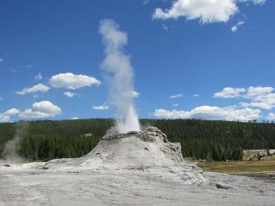
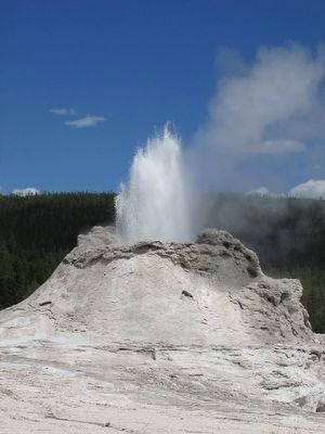
The massive cone is a sign of old age. Eruption after eruption, probably for thousands of years, scalding water has deposited this silica mineral formation. By contrast, Old Faithful’s fledgling cone may only be a few hundred years old.
Castle Geyser has dramatically changed its surroundings. By flooding the area with hot, silica-rich water, the geyser has devoured part of a pine forest and turned it into a thermal desert. Tree skeletons are entombed within the cone.
Castle Geyser’s eruptions are predictable; two per day are typically recorded.
Erected by Yellowstone National Park.
Topics. This historical marker is listed in this topic list: Natural Features.
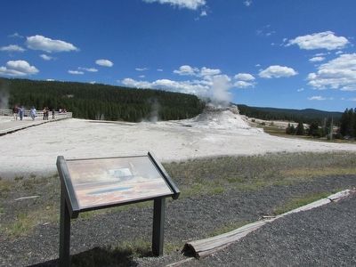
Location. 44° 27.817′ N, 110° 50.224′ W. Marker is in Yellowstone National Park, Wyoming, in Park County. It is in Mammoth. Marker can be reached from Lower Grand Loop Road (U.S. 287), on the left. Marker is located in the Upper Geyser Basin in Yellowstone National Park. Touch for map. Marker is in this post office area: Yellowstone National Park WY 82190, United States of America. Touch for directions.
Other nearby markers. At least 8 other markers are within walking distance of this marker. Crested Pool (within shouting distance of this marker); Grand Geyser (approx. 0.2 miles away); Beauty and Chromatic Pools (approx. 0.3 miles away); Beehive Geyser (approx. 0.4 miles away); Giant Geyser (approx. half a mile away); Snow-Movers (approx. 0.6 miles away); Daisy Geyser (approx. 0.6 miles away); Grotto Geyser (approx. 0.6 miles away). Touch for a list and map of all markers in Yellowstone National Park.
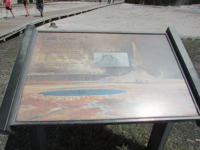
More about this marker. The background of the marker features a watercolor painted in 1872 by Thomas Moran depicting Castle Geyser. Vandalism has since destroyed some of Castle Geyser’s original symmetry. Elsewhere on the marker is a sketch of Castle Geyser done in 1870 by Walter Trumbull, a member of the Washburn expedition.
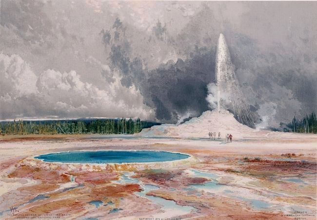
Photographed By Thomas Moran, 1872
5. The Castle Geyser, Upper Geyser Basin, Yellowstone National Park
This is the same image that forms the background for this marker, Thomas Moran's watercolor of the geyser. This chromolithograph version appeared in L. Prang's The Yellowstone National Park and the mountain region of portions of Idaho, Nevada, Colorado and Utah ..., published in 1874. Crested Pool is in the foreground.
Image courtesy of the Beinicke Library.
Image courtesy of the Beinicke Library.
Credits. This page was last revised on February 16, 2023. It was originally submitted on September 8, 2015, by Bill Coughlin of Woodland Park, New Jersey. This page has been viewed 366 times since then and 17 times this year. Photos: 1, 2, 3, 4. submitted on September 8, 2015, by Bill Coughlin of Woodland Park, New Jersey. 5. submitted on September 9, 2015.
