Prairie Grove in Washington County, Arkansas — The American South (West South Central)
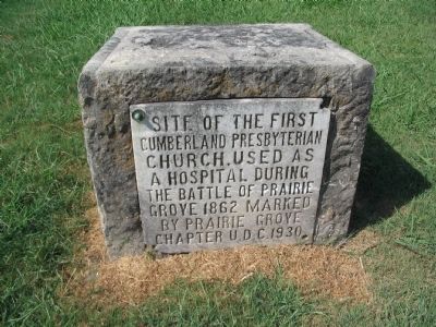
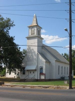
Cumberland Presbyterian Church
Cumberland Presbyterian
Church. Used as
a hospital during
the battle of Prairie
Grove 1862 marked
by Prairie Grove
Chapter U.D.C. 1930.
Erected 1930 by Prairie Grove Chapter of the United Daughters of the Confederacy.
Topics and series. This historical marker is listed in this topic list: War, US Civil. In addition, it is included in the United Daughters of the Confederacy series list. A significant historical year for this entry is 1862.
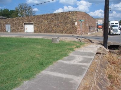
Location. 35° 58.547′ N, 94° 19.116′ W. Marker is in Prairie Grove, Arkansas, in Washington County. Marker is at the intersection of West Buchanan Street (U.S. 62) and Katie Smith Street, on the right when traveling west on West Buchanan Street. Touch for map. Marker is in this post office area: Prairie Grove AR 72753, United States of America. Touch for directions.
Other nearby markers. At least 8 other markers are within walking distance of this marker. Dr. James W. and Joy Nelson Webb (approx. 0.2 miles away); The Spring (approx. 0.2 miles away); 1959 Prairie Grove Telephone Co. Phone Booth (approx. 0.7 miles away); Hindman Hall Museum (approx. 0.7 miles away); General Shaver's Headquarters (approx. 0.7 miles away); Battlefield Park (approx. 0.7 miles away); Battle of Prairie Grove (approx. 0.7 miles away); March of the Armies (approx. 0.7 miles away). Touch for a list and map of all markers in Prairie Grove.
Credits. This page was last revised on June 16, 2016. It was originally submitted on September 11, 2010, by Craig Swain of Leesburg, Virginia. This page has been viewed 907 times since then and 21 times this year. Last updated on September 9, 2015, by Steve Masler of Memphis, Tennessee. Photos: 1, 2, 3. submitted on September 11, 2010, by Craig Swain of Leesburg, Virginia. • Bill Pfingsten was the editor who published this page.


