Memphis in Shelby County, Tennessee — The American South (East South Central)
Eastland Presbyterian Church

Photographed by Steve Masler, August 15, 2015
1. Eastland Presbyterian Church Marker
Erected by Shelby County Historical Commission.
Topics. This historical marker is listed in this topic list: Religion & Religious Structures. A significant historical date for this entry is November 11, 1906.
Location. 35° 10.734′ N, 89° 56.186′ W. Marker is in Memphis, Tennessee, in Shelby County. It is at the intersection of Jackson Ave (Tennessee Route 14) and Villa on Jackson Ave. Touch for map. Marker is at or near this postal address: 3741 Jackson Ave, Memphis TN 38108, United States of America. Touch for directions.

Regionally, this marker is in West Tennessee. It is also in the American South, specifically in the Deep South, in the Upper South, in the Mississippi Delta, and in the Great River Road Region. Globally, it is in North America, the Western
this page online
Other nearby markers. At least 8 other markers are within 3 miles of this marker, measured as the crow flies: Illinois Monument (approx. 0.3 miles away); Rose Garden (approx. 0.4 miles away); Memphis National Cemetery (approx. 0.4 miles away); U.S. Colored Troops and the Battle of Fort Pillow / Remember Fort Pillow (approx. 0.4 miles away); Raleigh Cemetery (approx. 1.9 miles away); Raleigh (approx. 2 miles away); Joseph "Joe" C. Warren (approx. 2.4 miles away); The Memphis 13 / Springdale Elementary School (approx. 2.6 miles away). Touch for a list and map of all markers in Memphis.
Additional commentary.
1. Permanently closed.
It is reported that this church is permanently closed. It also had an intentionally set fire in 2019.
— Submitted August 17, 2022.
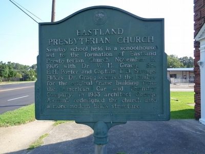
Photographed by Steve Masler, August 15, 2015
2. Eastland Presbyterian Church Marker
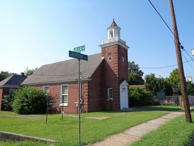
Photographed by Steve Masler, August 15, 2015
3. Eastland Presbyterian Church Marker
Credits. This page was last revised on August 17, 2022. It was originally submitted on August 16, 2015, by Steve Masler of Memphis, Tennessee. This page has been viewed 1,047 times since then and 48 times this year. Last updated on September 11, 2015, by Steve Masler of Memphis, Tennessee. Photos: 1, 2, 3. submitted on August 16, 2015, by Steve Masler of Memphis, Tennessee. • Bill Pfingsten was the editor who published this page.
