Scottsville in Albemarle County, Virginia — The American South (Mid-Atlantic)
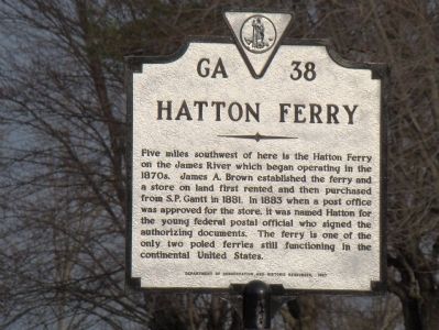
Hatton Ferry
Erected 1987 by Department of Conservation and Historic Resources. (Marker Number GA-38.)
Topics and series. This historical marker is listed in this topic list: Waterways & Vessels. In addition, it is included in the Virginia Department of Historic Resources (DHR) series list. A significant historical year for this entry is 1881.
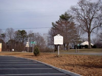
Location. 37° 48.48′ N, 78° 30.162′ W. Marker is in Scottsville, Virginia, in Albemarle County. Marker is at the intersection of Irish Road (Virginia Route 6) and James River Road, on the right when traveling west on Irish Road. Touch for map. Marker is in this post office area: Scottsville VA 24590, United States of America. Touch for directions.
Other nearby markers. At least 8 other markers are within 4 miles of this marker, measured as the crow flies. Scottsville Confederate Cemetery (approx. half a mile away); Historic Scottsville (approx. ¾ mile away); Hurricane Camille (approx. 0.8 miles away); Barclay House and Scottsville Museum (approx. 0.8 miles away); Scottsville (approx. 0.8 miles away); The Glebe (approx. 3.3 miles away); a different marker also named Hatton Ferry (approx. 3.4 miles away); a different marker also named Hatton Ferry (approx. 3½ miles away). Touch for a list and map of all markers in Scottsville.
Related markers. Click here for a list of markers that are related to this marker. These are the other Hatton Ferry markers.
Also see . . . The Hatton Ferry, ca. 1910. “The Hatton ferryboat is flat-bottomed with a deck hovering a few inches above the waterline. A stout cable is attached to one of the boat’s ends and guided by an overhead wire connecting the two river banks about 700 feet away. One cable allows the stern to swing gently downstream, following the current. The other retards a similar reaction by the prow, and together the cables control the craft in its river passage and harness the natural power of the river. The boat caught at an angle by the current, floats steadily across the river. As the ferry approaches the riverbank, the ferryman cranks a hand winch to roll up the cable at the boat’s stern. With a few jabs of the ferryman’s pole at the trip’s end, the ferry slips onto its riverbank landing.” (Submitted on April 15, 2009.)
Credits. This page was last revised on February 2, 2023. It was originally submitted on April 15, 2009, by J. J. Prats of Powell, Ohio. This page has been viewed 1,121 times since then and 26 times this year. Last updated on September 11, 2015, by Steve Masler of Memphis, Tennessee. Photos: 1, 2. submitted on April 15, 2009, by J. J. Prats of Powell, Ohio. • Bernard Fisher was the editor who published this page.

