Near Winterhaven in Imperial County, California — The American West (Pacific Coastal)
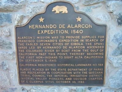
Hernando De Alarcon Expedition - 1540
Erected 1982 by State Department of Parks and Recreation in cooperation with the Quechan Tribal Council, The Imperial Irrigation District, Imperial Valley Pioneers, and Squibob Chapter of E Clampus Vitus. (Marker Number 568.)
Topics and series. This historical marker is listed in these topic lists: Exploration • Notable Places. In addition, it is included in the California Historical Landmarks, and the E Clampus Vitus series lists. A significant historical date for this entry is September 5, 1540.
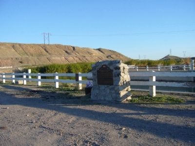
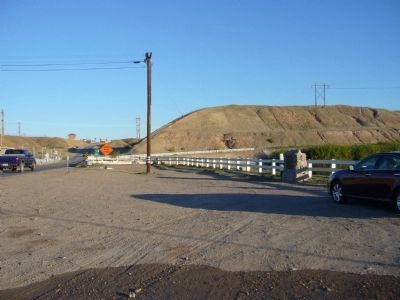
Location. 32° 44.242′ N, 114° 43.006′ W. Marker is near Winterhaven, California, in Imperial County. Marker is on Interstate 186, ¼ mile south of Interstate 8, on the left when traveling south. Take Exit 166 off of I-8. Touch for map. Marker is in this post office area: Winterhaven CA 92283, United States of America. Touch for directions.
Other nearby markers. At least 8 other markers are within 6 miles of this marker, measured as the crow flies. Mormon Battalion Crossing / Colorado River Crossing (approx. 1.8 miles away in Arizona); Site of Camp Pilot Knob (approx. 2.4 miles away); The Island of California (approx. 3 miles away); Immaculate Conception Parish (approx. 4.1 miles away in Arizona); U.S. Army of the West — Mormon Battalion (approx. 4.2 miles away in Arizona); Yuma Crossing (approx. 5.4 miles away in Arizona); Robert G. Fowler (approx. 5½ miles away in Arizona); a different marker also named Robert G. Fowler (approx. 5½ miles away in Arizona).
Regarding Hernando De Alarcon Expedition - 1540. This site was designated as California Registered Historical Landmark No.568 on
April 1, 1957.
Additional commentary.
1. Hernando D' (ah-lar-kon') Alarcon
ALARCON, Hernando d' (ah-lar-kon'), Spanish navigator, born early in the 16th century. He sailed from New Spain in May 1540 with two ships and a tender along the western coast of America, under instructions from Mendoza, the viceroy, to aid the land expedition of Coronado, which set out at the same time, in search of the seven cities of Cibola. He made a careful survey of the shoreline of the Californian peninsula, previously supposed to be an island, and returned to New Spain in 1541, having failed to meet the land expedition according to the plan. He also discovered the Colorado River, ascended that difficult stream for 100 miles, and took possession of the country in the name of Charles distributing crosses among the natives as a missionary of the Church, telling them that he was the "messenger of the sun." His charts and observations, supplementing those of Ulloa, accurately represented the configuration of California.
Source: Famous Americans - http://www.famousamericans.net/hernandodalarcon/
— Submitted March 27, 2010.
Credits. This page was last revised on May 14, 2022. It was originally submitted on March 23, 2010, by Bill Kirchner of Tucson, Arizona. This page has been viewed 2,865 times since then and 124 times this year. Last updated on September 12, 2015, by Steve Masler of Memphis, Tennessee. Photos: 1, 2, 3. submitted on March 23, 2010, by Bill Kirchner of Tucson, Arizona. • Syd Whittle was the editor who published this page.


