Port Republic in Rockingham County, Virginia — The American South (Mid-Atlantic)
Port Republic Foundry
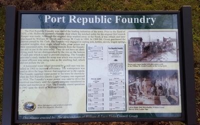
Photographed by Bernard Fisher, September 11, 2015
1. Port Republic Foundry Marker
A horizontal water wheel powered by a mill race was installed in 1903 to increase efficiency. The waterpower was used to drive the huge blower that supplied air to the cupola. The Foundry supplied water
this page online
(captions)
(top) Horses and wagon loaded with plow points made at the William M. Groah Foundry in the background.
(bottom) Left to Right: Bob Meyerhoffer, William Groah, Harvey Scott, Luther Sipe
This plaque erected by: The descendants of William & Lucy Viola Connell Groah
Erected by The Society of Port Republic Preservationists, Inc.
Topics. This historical marker is listed in this topic list: Industry & Commerce. A significant historical year for this entry is 1870.
Location. Marker is missing. It was located near 38° 17.552′ N, 78° 49.106′ W. Marker was in Port Republic, Virginia, in Rockingham County. It was on Water Street south of Main Street, on the left when traveling west. Touch for map. Marker was in this post office area: Port Republic VA 24471, United States of America. Touch for directions.

Regionally,
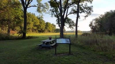
Photographed by Bernard Fisher, September 11, 2015
2. Port Republic Foundry Marker
Other nearby markers. At least 8 other markers are within 2 miles of this location, measured as the crow flies: A different marker also named Madison Hall (about 800 feet away); Riverside Graveyard (approx. 0.2 miles away); Palmer Lot at Middle Ford (approx. ¼ mile away); The Frank Kemper House (approx. half a mile away); Port Republic Battlefield (approx. half a mile away); North River Bridge (approx. half a mile away); The Point (approx. half a mile away); Battle of Port Republic (approx. 1.9 miles away). Touch for a list and map of all markers in Port Republic.
Other markers no longer nearby. Madison Hall (was about 700 feet away, measured in a direct line but has been replaced with another marker now near

Photographed by Bradley Owen, August 29, 2026
3. Port Republic Foundry Marker
Marker text is missing.
Also see . . . Port Republic Museum. The Society of Port Republic Preservationists, Inc. (Submitted on September 13, 2015.)
Credits. This page was last revised on August 31, 2026. It was originally submitted on September 13, 2015, by Bernard Fisher of Richmond, Virginia. This page has been viewed 997 times since then and 28 times this year. Photos: 1, 2. submitted on September 13, 2015, by Bernard Fisher of Richmond, Virginia. 3. submitted on August 31, 2026, by Bradley Owen of Morgantown, West Virginia.
