Marker Logo HMdb.org THE HISTORICAL
MARKER DATABASE
“Bite-Size Bits of Local, National, and Global History”
Lafayette in Sussex County, New Jersey — The American Northeast (Mid-Atlantic)
 

The Lafayette Foundry

1836


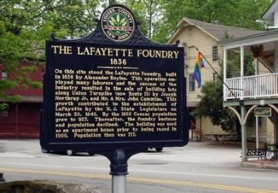
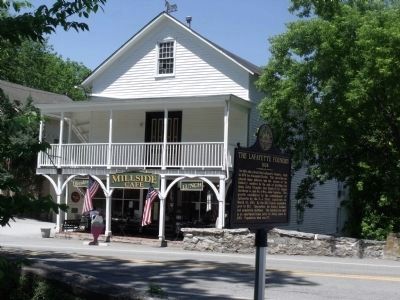
The Lafayette Foundry Marker image. Click for full size.
Photographed By Cheryl (Rome) Thom, June 4, 2008
1. The Lafayette Foundry Marker
Inscription. On this site stood the LaFayette Foundry, built in 1836 by Alexander Boyles. This operation employed many laborers and the success of the industry resulted in the sale of building lots along Union Turnpike (now Route 15) by Joseph Northrup, Jr. and Mr. & Mrs. John Cummins. This growth contributed to the establishment of Lafayette by the N.J. State Legislature on March 20, 1845. By the 1850 Census population grew to 927. Thereafter, the foundry business and population declined. The building was used as an apartment house prior to being razed in 1900. Population then was 717.
 
Erected 2007 by Sussex County Board of Chosen Freeholders and Sussex County Historic Marker Committee.
 
Topics and series. This historical marker is listed in these topic lists: Industry & CommerceSettlements & Settlers. In addition, it is included in the New Jersey, Sussex County Board of Chosen Freeholders series list. A significant historical year for this entry is 1836.
 
Location. 41° 5.886′ N, 74° 41.345′ W. Marker is in Lafayette, New Jersey, in Sussex County. Marker is at the intersection of Morris Farm Road (County Route 659) and New Jersey Route 15 on Morris Farm Road. Touch for map. Marker is in this post office area: Lafayette NJ 07848, United States of America. Touch for directions.
 
Other nearby markers. At least 8 other markers are within 5 miles of this marker, measured
Paid Advertisement
Click on the ad for more information.
Please report objectionable advertising to the Editor.
Click or scan to see
this page online
as the crow flies. Northwest New Jersey Vietnam Veterans Memorial (about 600 feet away, measured in a direct line); Unknown Soldier of the Revolution (approx. 2.8 miles away); Augusta Hill Baptists (approx. 2.9 miles away); Twin Bridges (approx. 3.6 miles away); Sussex County Public Safety Memorial (approx. 3.9 miles away); Newton Green (approx. 4.3 miles away); Sussex County Veterans Memorial (approx. 4.3 miles away); a different marker also named Newton Green (approx. 4.3 miles away).
 
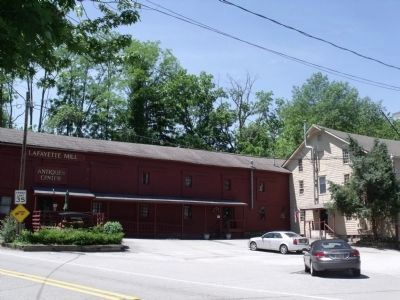
Old Mill across from marker location image. Click for full size.
Photographed By Cheryl (Rome) Thom, May 28, 2010
2. Old Mill across from marker location
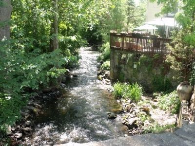
Brook located adjacent to marker image. Click for full size.
Photographed By Cheryl (Rome) Thom, May 28, 2010
3. Brook located adjacent to marker
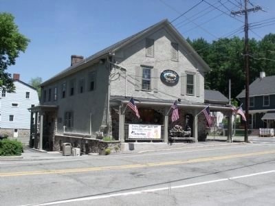
Historic stone structure across from site of marker image. Click for full size.
Photographed By Cheryl (Rome) Thom, May 28, 2010
4. Historic stone structure across from site of marker
Additional historic out-buildings near this marker image. Click for full size.
Photographed By Cheryl (Rome) Thom, May 28, 2010
5. Additional historic out-buildings near this marker
 
 
Credits. This page was last revised on June 16, 2016. It was originally submitted on February 8, 2010, by Cheryl (Rome) Thom of Newton, New Jersey. This page has been viewed 1,050 times since then and 42 times this year. Last updated on September 13, 2015, by Steve Masler of Memphis, Tennessee. Photos:   1. submitted on February 8, 2010, by Cheryl (Rome) Thom of Newton, New Jersey.   2, 3, 4, 5. submitted on June 2, 2010, by Cheryl (Rome) Thom of Newton, New Jersey. • Bill Pfingsten was the editor who published this page.
Share this page.  
Share on Tumblr
m=88587

CeraNet Cloud Computing sponsors the Historical Marker Database.
This website earns income from purchases you make after using our links to Amazon.com. We appreciate your support.
Paid Advertisement
Apr. 19, 2024