Near Mingus in Erath County, Texas — The American South (West South Central)
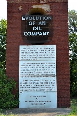
Evolution of an Oil Company

Photographed by Gary Estep, January 3, 2026
1. Evolution of an Oil Company Marker
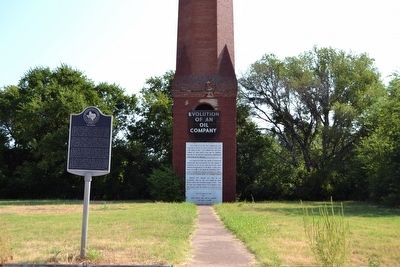
The transition from coal mining to petroleum production was accelerated by the company’s discovery in 1917 of oil and gas in the Great Ranger Field, 16 miles to the west. It was a natural evolution of an American enterprise dedicated to developing natural resources to supply the nation’s growing needs for abundant energy.
Beneath this ground lies part of the 127,000,000 tons of coal still owned by Texas Pacific, which may be mined in the future. This is Texas’ only known deposit of bituminous coal and occurs from the surface to a depth of 450 feet.
by
Texas Pacific Coal and Oil Company,
Fort Worth, Texas
Erected 1960 by Texas Pacific Coal and Oil Company.
Topics. This historical marker is listed in these topic lists: Industry & Commerce • Settlements & Settlers. A significant historical year for this entry is 1888.
Location. 32° 30.475′ N, 98° 24.949′ W.
this page online

Regionally, this marker is in the Prairies & Lakes Region. Globally, it is in North America, a Gulf of Mexico state, the Western Hemisphere, the Western World, and the Anglosphere. Historically, it finds itself in what was once New Spain, the Comanchería, the Republic of Texas, and one of the Confederate States of America.
Other nearby markers. At least 8 other markers are within walking distance of this marker: Thurber (within shouting distance of this marker); Site of Hotel Knox and Thurber Mining Office (about 600 feet away, measured in a direct line); New York Hill (approx. 0.2 miles away); Site of Thurber's First Coal Mine (approx. ¼ mile away); Site of Thurber Brick Plant (approx. ¼ mile away); St. Barbara's Catholic Church (approx. ¼ mile away); Thurber Cemetery (approx. ¼ mile away); Whitehead Cemetery (approx. 0.3 miles away). Touch for a list and map
Photographed by Duane Hall, August 22, 2015
2. Evolution of an Oil Company Marker
Photographed by Duane Hall, August 22, 2015
3. Thurber and Evolution of an Oil Company Markers
Photographed by Duane Hall, August 22, 2015
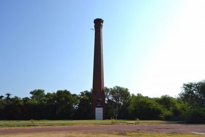
4. Texas & Pacific Coal Company Smokestack
Photographed by Duane Hall, August 22, 2015
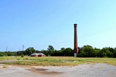
5. Texas & Pacific Coal Company Smokestack
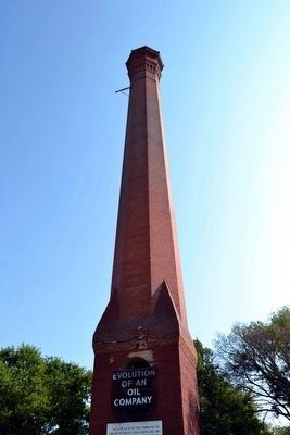
Photographed by Duane Hall, August 22, 2015
6. Texas & Pacific Coal Company Smokestack
Credits. This page was last revised on January 4, 2026. It was originally submitted on September 14, 2015, by Duane Hall of Abilene, Texas. This page has been viewed 1,064 times since then and 90 times this year. Photos: 1. submitted on January 3, 2026, by Gary Estep of Anna, Texas. 2, 3, 4, 5, 6. submitted on September 14, 2015, by Duane Hall of Abilene, Texas.
