Grand Teton National Park in Teton County, Wyoming — The American West (Mountains)
Geologic Drama
Grand Teton National Park
Photographed by Bill Coughlin, July 27, 2015
1. Geologic Drama Marker
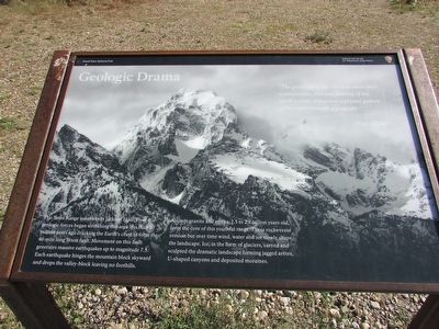
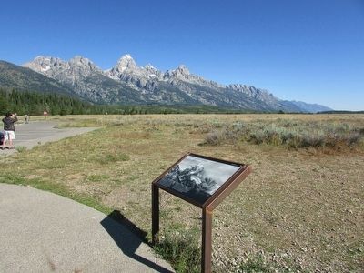
The Teton Range towers over Jackson Hole. Powerful geologic forces began stretching this area less than 10 million years ago cracking the Earth’s crust to form the 40-mile long Teton fault. Movement on this fault generates massive earthquakes up to magnitude 7.5. Each earthquake hinges the mountain block skyward and drops the valley-block leaving no foothills.
Ancient granite and gneiss, 2.5 to 2.7 billion years ago, from the core of this youthful range. These rocks resist erosion but over time wind, water and ice slowly shape the landscape. Ice, in the form of glaciers, carved and sculpted the dramatic landscape forming jagged arêtes, U-shaped canyons and deposited moraines.
“The grand lift of the Tetons is more than a mechanistic fold and faulting of the earth’s crust; it becomes a primal gesture of the earth beneath a great sky.”
Erected by National Park Service.
Topics. This historical marker is listed in this topic list: Natural Features.
Location. 43° 40.635′ N, 110° 43.471′ W. Marker is in Grand Teton National Park, Wyoming, in Teton County. It is
this page online

Regionally, this marker is in the Jackson Hole Area and in Greater Yellowstone. It is also in the American Mountain West. Globally, it is in North America, the Rocky Mountains, the Western Hemisphere, the Western World, and the Anglosphere.
Other nearby markers. At least 8 other markers are within 2 miles of this marker, measured as the crow flies: Foundations of a Community (a few steps from this marker); A Spiritual Heart in the Park (approx. 1.3 miles away); Walk Back in Time (approx. 1.3 miles away); Making it Last (approx. 1.4 miles away); Staying Cool (approx. 1.4 miles away); “Mean and Menor” (approx. 1.4 miles away); Water Filter (approx. 1.4 miles away); Menor’s Ferry (approx. 1.4 miles away). Touch for a list and map of all markers in Grand Teton National Park.
Photographed by Bill Coughlin, July 27, 2015
2. Geologic Drama Marker
Photographed by Bill Coughlin, July 27, 2015
3. Markers at Grand Teton National Park
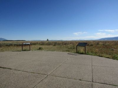
Two markers can be found at this location. The Geologic Drama marker can be seen here on the left.
Credits. This page was last revised on November 21, 2024. It was originally submitted on September 16, 2015, by Bill Coughlin of Woodland Park, New Jersey. This page has been viewed 565 times since then and 19 times this year. Photos: 1, 2, 3. submitted on September 16, 2015, by Bill Coughlin of Woodland Park, New Jersey.
