Near Georgetown in Scott County, Kentucky — The American South (East South Central)
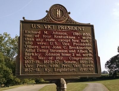
U.S. Vice President
Erected 1964 by Kentucky Historical Society, Kentucky Department of Highways. (Marker Number 739.)
Topics and series. This historical marker is listed in this topic list: Government & Politics. In addition, it is included in the Former U.S. Presidents: #08 Martin Van Buren, and the Kentucky Historical Society series lists.
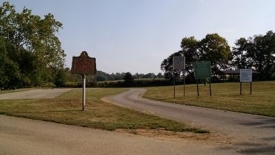
Location. 38° 12.977′ N, 84° 36.291′ W. Marker is near Georgetown, Kentucky, in Scott County. Marker can be reached from Stamping Ground Road (State Highway 227) 0.4 miles north of Frankfort Pike (U.S. 460), on the left when traveling east. Marker is located within Great Crossing Park. Touch for map. Marker is in this post office area: Georgetown KY 40324, United States of America. Touch for directions.
Other nearby markers. At least 8 other markers are within 3 miles of this marker, measured as the crow flies. Johnson Family Cemetery (approx. 0.2 miles away); Robert Johnson / Jemima Suggett Johnson (approx. 0.2 miles away); LaFayette's Tour (approx. 0.2 miles away); Choctaw Indian Academy (approx. 0.4 miles away); Ward Hall (approx. one mile away); Cardome (approx. 2.1 miles away); Hemp in Scott County / Hemp in Kentucky (approx. 2.1 miles away); Payne-Desha House / Joseph Desha (1768-1842) (approx. 2.3 miles away). Touch for a list and map of all markers in Georgetown.
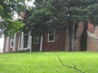
Regarding U.S. Vice President. House mentioned on the marker is located on Galloway Pike, approximately 0.7 mile north of Frankfort Pike, at coordinates 38.219801, -84.651220. Private residence not open to the public.
Also see . . . Richard Mentor Johnson. (Submitted on September 17, 2015, by Dave Knoch of Scott County, Kentucky.)
Credits. This page was last revised on December 22, 2020. It was originally submitted on September 17, 2015, by Dave Knoch of Scott County, Kentucky. This page has been viewed 722 times since then and 50 times this year. Photos: 1, 2, 3, 4. submitted on September 17, 2015, by Dave Knoch of Scott County, Kentucky. • Bill Pfingsten was the editor who published this page.


