Near Grenville in Union County, New Mexico — The American Mountains (Southwest)
The Santa Fe Trail
Santa Fe Trail National Scenic Byway

Photographed by Mark Hilton, September 15, 2015
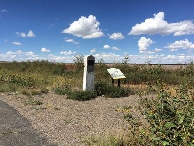
1. The Santa Fe Trail Marker
Here, near two landmarks of the trail, Round Mound and Rabbit Ears, wagon trains camped for the night. William Becknell, the trader who inaugurated the Santa Fe Trail in 1821, came this way on his return trip east while forging the smoother Cimarron Route across the plains.
Two-way Street
Unlike the great emigrant trails to the north, the Santa Fe Trail ran both ways, with traders from Mexico, or returning U.S. traders, carrying Mexican silver, gold, mules, buffalo and beaver pelts to waiting markets in Missouri.
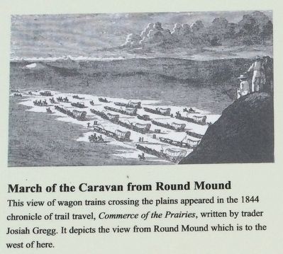
"As the caravans passed under the northern base of the Round Mound, it presented a very fine and imposing spectacle to those who were upon its summit. The wagons marched slowly in four parallel columns . . . .The unceasing 'crack, crack,' of the wagoners' whips, resembling the frequent reports of distant guns."
Trader
this page online
Topics and series. This historical marker is listed in these topic lists: Roads & Vehicles • Settlements & Settlers. In addition, it is included in the Santa Fe Trail series list. A significant historical year for this entry is 1821.
Location. 36° 33.992′ N, 103° 34.019′ W. Marker is near Grenville, New Mexico, in Union County. It is on U.S. 64 0.3 miles south of 1st Street (Road 453), on the left when traveling south. Touch for map. Marker is in this post office area: Grenville NM 88424, United States of America. Touch for directions.

Regionally, this marker is in Eastern New Mexico. It is also in the American Southwest, in the Mountain West, on the Great Plains, on the Southern Plains, on the High Plains, and on the Santa Fe Trail Corridor. Globally, it is in North America, the Rocky Mountains, the Western Hemisphere, the Western World, and the Anglosphere. Historically, it finds itself in what was once New Spain, the Comanchería, the Dust Bowl, and the Republic of Texas.
Other nearby markers. At least one other marker is within walking
Photographed by Mark Hilton, September 15, 2015
2. Two Santa Fe Trail Markers
Related markers. Click here for a list of markers that are related to this marker.
Also see . . .
1. Santa Fe Trail. Wikipedia entry (Submitted on May 13, 2026, by Larry Gertner of New York, New York.)
2. William Becknell. Wikipedia entry (Submitted on September 19, 2015, by Mark Hilton of Montgomery, Alabama.)
Photographed by Mark Hilton, September 15, 2015
3. Santa Fe Trail depiction.
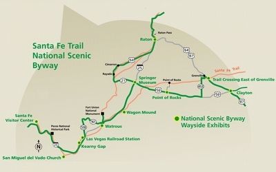
the Federal Highway Administration and the New Mexico Department of Tourism.
4. Santa-Fe Trail Map in New Mexico
Credits. This page was last revised on May 19, 2026. It was originally submitted on September 19, 2015, by Mark Hilton of Montgomery, Alabama. This page has been viewed 1,267 times since then and 95 times this year. Photos: 1, 2, 3, 4. submitted on September 19, 2015, by Mark Hilton of Montgomery, Alabama.
