Snyder in Scurry County, Texas — The American South (West South Central)
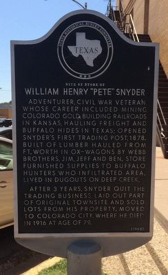
Site of Store of William Henry "Pete" Snyder
Inscription.
Adventurer, Civil War veteran, whose career included mining Colorado gold, building railroads in Kansas, hauling freight and buffalo hides in Texas; opened Snyder's first trading post, 1878. Built of lumber hauled from Ft. Worth in ox-wagons by Webb Brothers, Jim, Jeff and Ben. Store furnished supplies to buffalo hunters who infiltrated area, lived in dugouts on Deep Creek.
After 3 years, Snyder quit the trading business, laid out part of original townsite and sold lots from his property. Moved to Colorado City, where he died in 1916 at age of 79.
Erected 1968 by State Historical Survey Committee. (Marker Number 4891.)
Topics. This historical marker is listed in these topic lists: Industry & Commerce • Settlements & Settlers. A significant historical year for this entry is 1878.
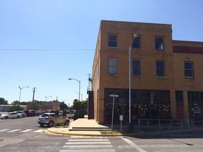
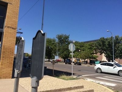
Location. 32° 42.96′ N, 100° 55.036′ W. Marker is in Snyder, Texas, in Scurry County. Marker is at the intersection of 26th Street and Avenue R, on the right when traveling east on 26th Street. Touch for map. Marker is at or near this postal address: 1802 26th Street, Snyder TX 79549, United States of America. Touch for directions.
Other nearby markers. At least 8 other markers are within walking distance of this marker. Site of Sanitarium of Alonzo Orrin Scarborough (here, next to this marker); Site of The MacKenzie Trail (within shouting distance of this marker); Santa Fe Railway in Scurry County (within shouting distance of this marker); The Press in Snyder (about 300 feet away, measured in a direct line); Scurry County's Canyon Reef Oil Field (about 300 feet away); County's First Law Men (about 300 feet away); Scurry County (about 400 feet away); Scurry County Courthouse Site and Building (about 400 feet away). Touch for a list and map of all markers in Snyder.
Also see . . . Texas State Historical Association article on Snyder. (Submitted on September 21, 2015, by Mark Hilton of Montgomery, Alabama.)
Additional keywords. 32.716006, -100.917264
Credits. This page was last revised on June 16, 2016. It was originally submitted on September 21, 2015, by Mark Hilton of Montgomery, Alabama. This page has been viewed 429 times since then and 22 times this year. Photos: 1, 2, 3. submitted on September 21, 2015, by Mark Hilton of Montgomery, Alabama.


