Cojutepeque, Cuscatlán, El Salvador — Central America (West Coast)
History of Cerro de las Pavas
Historia del Cerro de las Pavas
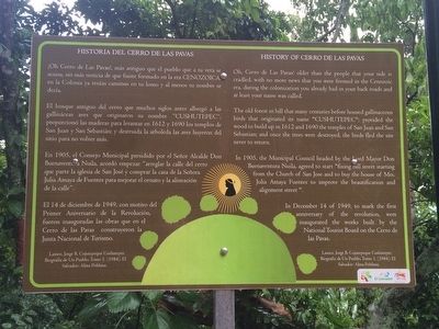
El bosque antiguo del cerro que muchos siglos antes albergó a las gallináceas aves que originaron su nombre “Cushutepec”; proporcionó las maderas para levantar en 1612 y 1690 los templos de San Juan y San Sebastián; y destruida la arboleda las aves huyeron del sitio para no volver más.
En 1905, el Consejo Munipal presidido por el Señor Alcalde Don Buenaventura Nuila, acordó empezar “arreglar la calle del cerro que parte la iglesia de San José y comprar la casa de la Señora Julia Amaya de Fuentes para mejorar el ornato y la alineación de la calle”.
El 14 de diciembre de 1949, con motivo del Primer Aniversario de la Revolución, fueron inauguradas las obras que en el Cerro de las Pavas construyeron la Junta Nacional de Turismo.
Lainez, Jorge B. Cojutepeque Cushutepec, Biografía de Un Pueblo, Tomo I. (1984). El Salvador: Alma Poblana.
History of Cerro de la Pavas
Oh, Cerro de Las Pavas! Older than the people that your side is cradled, with no more news that you were formed in the Cenozoic era, during the colonization you already had in your back roads and at least your name was called.
The old forest in hill that many centuries before housed gallinaceous birds that originated its name “Cushutepec”; provided for the wood to build up in 1612 and 1690 the temples of San Juan and San Sebastian; and once the trees were destroyed, the birds fled the site never to return.
In 1905, the Municipal Council headed by the Lord Mayor Don Buenaventura Nuila, agreed to start “fixing hill street starting from the Church of San Jose and to buy the house of Mrs. Julia Amaya Fuentes to improve the beautification and alignment street”.
In December 14 of 1949, to mark the first anniversary of the revolution, were inaugurated the works built by the National Tourist Board on the Cerro de las Pavas.
Topics. This historical marker is listed in this topic list: Notable Places. A significant historical date for this entry is December 14, 1949.
Location. 13° 42.783′ N, 88° 56.173′ W. Marker is in Cojutepeque, Cuscatlán. Touch for map. Marker is in this post office area: Cojutepeque, Cuscatlán 01401, El Salvador. Touch for directions.
Other nearby markers. At least 8 other markers are within 19 kilometers of this marker, measured as the crow flies. History of the Virgin of Fatima in Cerro de las Pavas (a few steps from this
marker); Expansion of El Salvador's Telephone System (about 90 meters away, measured in a direct line); Father Alirio Napoleón Macías (approx. 16.2 kilometers away); History of Ilobasco (approx. 16.7 kilometers away in Cabañas); Father Marino Braspenning (approx. 17.2 kilometers away in Cabañas); Apastepeque (approx. 17.6 kilometers away in San Vicente); Structure 1D1 or Southern Surveillance Point (approx. 19.2 kilometers away); Streets of Ciudad Vieja (approx. 19.3 kilometers away). Touch for a list and map of all markers in Cojutepeque.
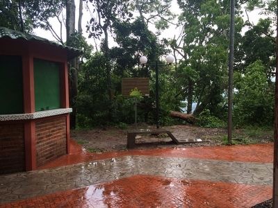
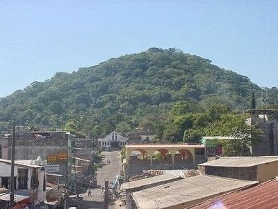
Regarding History of Cerro de las Pavas. As the marker explains, Cerro de Pavas ("Cushutepec" in Nahuat or "Hill of the Large Birds" in English) has a long history. In the 1600s its wood was logged to build churches in the nearby town of Cojutepeque. More recently local authorities in 1905 and 1949 built a road to the top and a nature park. This park now houses a pilgrimage site to the Virgin Mary built soon after the park's inauguration in 1949.
Credits. This page was last revised on July 28, 2019. It was originally submitted on September 21, 2015, by J. Makali Bruton of Accra, Ghana. This page has been viewed 573 times since then and 39 times this year. Photos: 1, 2, 3. submitted on September 21, 2015, by J. Makali Bruton of Accra, Ghana.


