
Mammoth in Yellowstone National Park in Park County, Wyoming — The American West (Mountains)
Land of Lodgepoles
Living with Fire
Photographed by Bill Coughlin, August 1, 2015
1. Land of Lodgepoles Marker
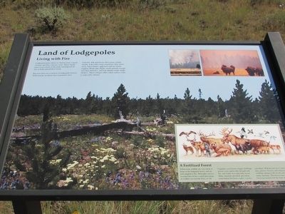
Lodgepole pines thrive in Yellowstone’s harsh climate and thin volcanic soils. These hardy trees cover much of the park and depend on fire to help spread their seeds.
Because fire are common in lodgepole forests, Yellowstone residents have learned to live with fire. Elk and bison often graze calmly nearby. Like other large mammals, they move away when flames approach and are rarely trapped. Birds take flight, small animals escape into their burrows, and fish inhabit ready-made shelters. These refuges offer safety unless a fire is especially intense.
A Fertilized Forest
Yellowstone wildlife are very much at home in the lodgepole forest, and are well adapted to fire. Helicopter surveys revealed that all but a small percentage of wildlife survived the Fires of ’88. Ungulates soon faced a bigger challenge: grasses were sparse after drought and fire, and winter was especially severe. Many ungulates perished, providing nourishment for bears, eagles, coyotes, and others. With the arrival of warm days, grasses, flowers, and lodgepole seedlings sprang to life in ash-enriched sunny openings. This forest home had been rejuvenated with
this page online
Erected by National Park Service.
Topics. This historical marker is listed in these topic lists: Animals • Horticulture & Forestry.
Location. 44° 39.09′ N, 111° 2.063′ W. Marker is in Yellowstone National Park, Wyoming, in Park County. It is in Mammoth. It can be reached from West Entrance Road (U.S. 287), on the right when traveling west. Marker is located on the Two Ribbons Trail. Touch for map. Marker is in this post office area: Yellowstone National Park WY 82190, United States of America. Touch for directions.

Regionally, this marker is in the Bighorn Basin and in Greater Yellowstone. It is also in the American Mountain West and in the Lewis & Clark Corridor. Globally, it is in North America, the Rocky Mountains, the Western Hemisphere, the Western World, and the Anglosphere.
Other nearby markers. At least 8 other markers are within 4 miles of this marker, measured as the crow flies: Madison River (about 400 feet away, measured in a direct line); Union Pacific Identification Pylon (approx. 3.1 miles away in Montana); Montana's Centennial Train
Photographed by Bill Coughlin, August 1, 2015
2. Land of Lodgepoles Marker
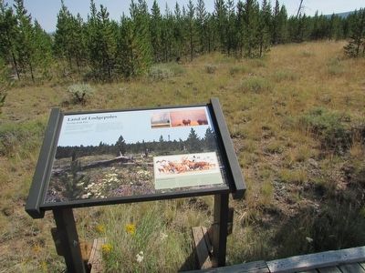
More about this marker. The background of the marker contains a photograph of the forest a few years after the Fire of '88.
Photographed by Bill Coughlin, August 1, 2015
3. Marker on the Two Ribbons Trail
Photographed by Bill Coughlin, August 1, 2015
4. Two Ribbons Trail
Credits. This page was last revised on February 16, 2023. It was originally submitted on September 22, 2015, by Bill Coughlin of Woodland Park, New Jersey. This page has been viewed 629 times since then and 24 times this year. Photos: 1, 2, 3, 4. submitted on September 22, 2015, by Bill Coughlin of Woodland Park, New Jersey.
