Earlington in Hopkins County, Kentucky — The American South (East South Central)
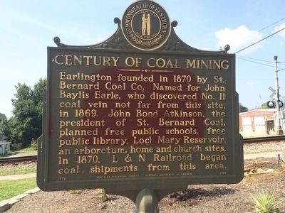
Century of Coal Mining
Erected 1970 by Kentucky Historical Society Kentucky Department of Highways. (Marker Number 1338.)
Topics and series. This historical marker is listed in these topic lists: Education • Industry & Commerce • Railroads & Streetcars • Settlements & Settlers. In addition, it is included in the Kentucky Historical Society series list. A significant historical year for this entry is 1870.
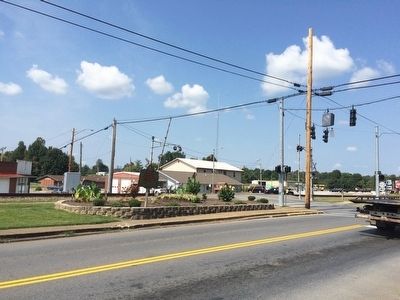
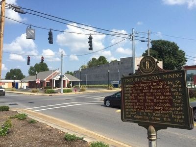
Location. 37° 16.434′ N, 87° 30.735′ W. Marker is in Earlington, Kentucky, in Hopkins County. Marker is at the intersection of South Lee Trover Todd Jr Highway (U.S. 41) and West Main Street (State Route 112), on the left when traveling north on South Lee Trover Todd Jr Highway. Touch for map. Marker is at or near this postal address: 102 East Main Street, Earlington KY 42410, United States of America. Touch for directions.
Other nearby markers. At least 8 other markers are within 4 miles of this marker, measured as the crow flies. J.W. Million School / Prof. Lester G. Mimms (approx. ¼ mile away); Munns School (approx. 3 miles away); Oliver Loving (approx. 3.3 miles away); Chittenden P. Lyon, Jr. House (approx. 3½ miles away); Carlow's Stone Wall (approx. 3½ miles away); Turner Ruby House (approx. 3.6 miles away); The Hockersmith House (approx. 3.6 miles away); Gov. Ruby Laffoon (approx. 3.7 miles away).
Credits. This page was last revised on October 30, 2020. It was originally submitted on September 23, 2015, by Mark Hilton of Montgomery, Alabama. This page has been viewed 387 times since then and 37 times this year. Photos: 1, 2, 3, 4, 5. submitted on September 23, 2015, by Mark Hilton of Montgomery, Alabama.
