Sheridan in Sheridan County, Wyoming — The American West (Mountains)
A Place of Shelter
Wyoming’s Agriculture
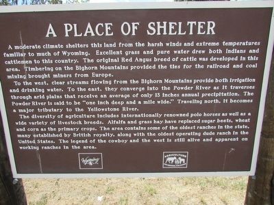
A moderate climate shelters this land from the harsh winds and extreme temperatures familiar to much of Wyoming. Excellent grass and pure water drew both Indians and cattlemen to this country. The original Red Angus breed of cattle was developed in this area. Timbering on the Bighorn Mountains provided the ties for the railroad and coal mining brought miners from Europe.
To the west, clear streams flowing from the Bighorn Mountains provide both irrigation and drinking water. To the east, they converge into the Powder River as it traverses through arid plains that receive an average of only 13 inches annual precipitation. The Powder River is said to be “one inch deep and a mile wide.” Traveling north, it becomes a major tributary to the Yellowstone River.
The diversity of agriculture includes internationally renowned polo horses as well as a wide variety of livestock breeds. Alfalfa and grass hay have replaced sugar beets, wheat and corn as the primary crops. The area contains some of the oldest ranches in the state, many established by British royalty, along with the oldest operating dude ranch in the United States. The legend of the cowboy and the west is still alive and apparent on working ranches in the area.
Erected by State of Wyoming.
Topics. This historical marker is listed in this topic list: Agriculture.
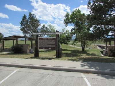
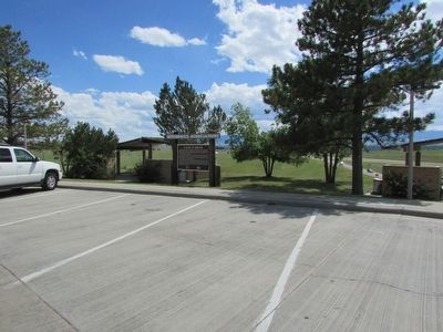
Location. 44° 48.335′ N, 106° 56.082′ W. Marker is in Sheridan, Wyoming, in Sheridan County. Marker can be reached from E 5th Street (County Route 336), on the left when traveling east. Marker is located in the Sheridan Travel & Tourism Rest Area. Touch for map. Marker is in this post office area: Sheridan WY 82801, United States of America. Touch for directions.
Other nearby markers. At least 8 other markers are within 2 miles of this marker, measured as the crow flies. Big Horns (within shouting distance of this marker); The Sheridan Railway Company (approx. ¼ mile away); The Black Diamond Trail (approx. 0.3 miles away); The Black Diamonds of Sheridan County (approx. 0.3 miles away); Class 0-5-A Mohawk Locomotive (approx. 0.9 miles away); Historic Sheridan Inn (approx. 0.9 miles away); First Cabin in Sheridan (approx. 1.2 miles away); General George Crook (approx. 1½ miles away). Touch for a list and map of all markers in Sheridan.
Credits. This page was last revised on June 16, 2016. It was originally submitted on September 25, 2015, by Bill Coughlin of Woodland Park, New Jersey. This page has been viewed 299 times since then and 17 times this year. Photos: 1, 2, 3. submitted on September 25, 2015, by Bill Coughlin of Woodland Park, New Jersey.


