Stamping Ground in Scott County, Kentucky — The American South (East South Central)
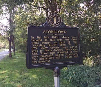
Stonetown
Erected 2012 by Kentucky Historical Society, Kentucky Department of Highways. (Marker Number 2375.)
Topics and series. This historical marker is listed in these topic lists: African Americans • Settlements & Settlers. In addition, it is included in the Kentucky Historical Society series list.
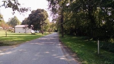
Location. 38° 16.694′ N, 84° 41.038′ W. Marker is in Stamping Ground, Kentucky, in Scott County. Marker is on Stonetown Road, 0.2 miles east of Locust Fork Road, on the left when traveling east. Touch for map. Marker is in this post office area: Stamping Ground KY 40379, United States of America. Touch for directions.
Other nearby markers. At least 8 other markers are within 7 miles of this marker, measured as the crow flies. Buffalo Springs (approx. half a mile away); Stamping Ground (approx. half a mile away); Lindsay's Station (approx. 1.4 miles away); Branham's Mill / Galloway Pike Iron Bridge (approx. 3˝ miles away); Switzer Covered Bridge (approx. 4˝ miles away); St. Francis Church (approx. 5 miles away); U.S. Vice President (approx. 6.1 miles away); Johnson Family Cemetery (approx. 6.2 miles away). Touch for a list and map of all markers in Stamping Ground.
Credits. This page was last revised on June 16, 2016. It was originally submitted on October 1, 2015, by Dave Knoch of Scott County, Kentucky. This page has been viewed 514 times since then and 26 times this year. Photos: 1, 2. submitted on October 1, 2015, by Dave Knoch of Scott County, Kentucky. • Bill Pfingsten was the editor who published this page.

