Marker Logo HMdb.org THE HISTORICAL
MARKER DATABASE
“Bite-Size Bits of Local, National, and Global History”
Near Capulin in Union County, New Mexico — The American Mountains (Southwest)
 

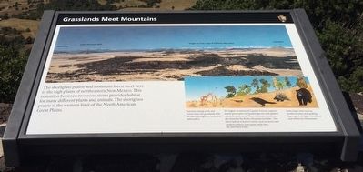
Grasslands Meet Mountains


Grasslands Meet Mountains Marker image. Click for full size.
Photographed By Mark Hilton, September 15, 2015
1. Grasslands Meet Mountains Marker
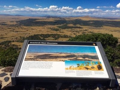
Inscription. The shortgrass prairie and mountain forest meet here in the high plains of northeastern New Mexico. This transition between two ecosystems provides habitat for many different plants and animals. The shortgrass prairie is the western limit of the North American Great Plains.
 
Erected by National Park Service, Department of the Interior.
 
Topics. This historical marker is listed in these topic lists: Natural FeaturesNatural Resources.
 
Location. 36° 46.956′ N, 103° 58.341′ W. Marker is near Capulin, New Mexico, in Union County. Marker is on Volcano Road, 2.6 miles east of State Road 325, on the right when traveling south. Touch for map. Marker is at or near this postal address: 46 Volcano Road, Capulin NM 88414, United States of America. Touch for directions.
 
Other nearby markers. At least 8 other markers are within 7 miles of this marker, measured as the crow flies. The Raton-Clayton Volcanic Field (a few steps from this marker); Making A Monument (a few steps from this marker); Building a Cinder Cone (a few steps from this marker); Welcome to Capulin Volcano National Monument (approx. half a mile away); Capulin Volcano National Monument (approx. 2.6 miles away); a different marker also named Capulin Volcano National Monument
Paid Advertisement
Click on the ad for more information.
Please report objectionable advertising to the Editor.
Click or scan to see
this page online
(approx. 3.1 miles away); Sarah "Sally" J. Rooke / New Mexico Historic Women Marker Initiative (approx. 5.3 miles away); Sierra Grande (approx. 6.8 miles away). Touch for a list and map of all markers in Capulin.
 
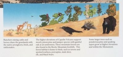
Grasslands Meet Mountains graphic from marker. image. Click for full size.
Photographed By Mark Hilton, September 15, 2015
2. Grasslands Meet Mountains graphic from marker.
Grasslands Meet Mountains Marker and lava field. image. Click for full size.
Photographed By Mark Hilton, September 15, 2015
3. Grasslands Meet Mountains Marker and lava field.
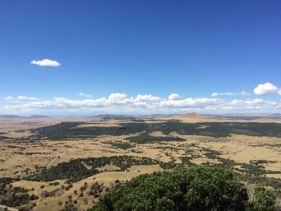
Grasslands Meet Mountains and lava field image. Click for full size.
Photographed By Mark Hilton, September 15, 2015
4. Grasslands Meet Mountains and lava field
Grasses of the cinder cone. image. Click for full size.
Photographed By Mark Hilton, September 15, 2015
5. Grasses of the cinder cone.
 
 
Credits. This page was last revised on June 16, 2016. It was originally submitted on October 1, 2015, by Mark Hilton of Montgomery, Alabama. This page has been viewed 465 times since then and 18 times this year. Photos:   1, 2, 3, 4, 5. submitted on October 1, 2015, by Mark Hilton of Montgomery, Alabama.
Share this page.  
Share on Tumblr
m=89230

CeraNet Cloud Computing sponsors the Historical Marker Database.
This website earns income from purchases you make after using our links to Amazon.com. We appreciate your support.
Paid Advertisement
May. 9, 2024