Near Carvers in Nye County, Nevada — The American Mountains (Southwest)
Ophir
Photographed by Trev Meed, 2014
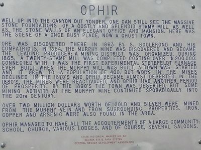
1. Ophir Marker
Well up into the canyon out yonder, one can still see the massive stone foundations of a costly and splendid stamp mill, as well as, the stone walls of an elegant office and mansion. Here was the scene of once busy place, now a ghost town.
Ore was discovered there in 1863 by S. Boulerond and his compatriots. In 1864, the Murphy Mine was discovered and became the leading producer; a mining district was organized. During 1865, a twenty-stamp mill was completed costing over $200,000. Connected with it was the first experimental Stetefedlt Furnace ever built. When the Murphy Mill was built, a town was started and it grew to a population of 400, but work in the mines declined in the 1870's and Ophir became almost deserted. In the 1880's, the mines reactivated, and Ophir had another period of prosperity. By the 1890's the town was deserted, but some mining activity at the Murphy Mine continued sporadically into the 20th Century.
Over two million dollars worth of gold and silver were mined from the Murphy Vein and from surrounding properties. Iron, copper and arsenic were also found in the area.
Ophir managed to have all the accouterments
this page online
Erected by Nevada State Park System - Central Nevada Development Association. (Marker Number 64.)
Topics. This historical marker is listed in these topic lists: Industry & Commerce • Settlements & Settlers. A significant historical year for this entry is 1863.
Location. 38° 56.328′ N, 117° 11.847′ W. Marker is near Carvers, Nevada, in Nye County. It is at the intersection of Highway 376 and NF-017 (dirt road), on the left when traveling north on Highway 376. Touch for map. Marker is in this post office area: Round Mountain NV 89045, United States of America. Touch for directions.

Regionally, this marker is in the Mojave Desert and in Central Nevada. It is also in the American Southwest and in the Mountain West. Globally, it is in North America, the Western Hemisphere, the Western World, and the Anglosphere. Historically, it finds itself in what was once New Spain and also Mexico’s Alta California.
Other nearby markers. At least 2 other markers are within 11 miles of this marker, measured as the crow flies: Tate's Stage Station (approx.
Photographed by Trev Meed, August 28, 2009
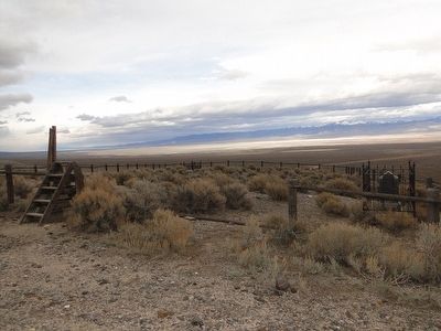
2. Ophir Cemetery
No opening — Wooden steps for going over the fence.
Regarding Ophir. If trying to reach the actual ghost town of Ophir, to the west, please be very careful. This trip is not for the casual traveler, and it requires 4 Wheel Drive. The photos here were all taken prior to engaging 4 Wheel Drive.
Also see . . .
1. Ophir - Nevada Ghost Town. An article on the history of Ophir including several photos of ruins of remaining buildings. (Submitted on October 11, 2015.)
2. Western Mining History - Ophir, Nevada. Includes a link to 27 photos of the ghost town. (Submitted on October 11, 2015.)
Photographed by Trev Meed, August 14, 2010
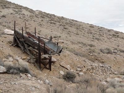
3. Ophir Mining Relic
Photographed by Trev Meed, August 28, 2009
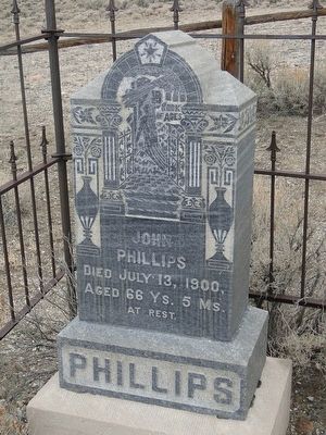
4. Gravestone of John Phillips.

courtesy Atlas Obscura
5. Stamp Mill ruins
Credits. This page was last revised on May 10, 2026. It was originally submitted on October 8, 2015. This page has been viewed 769 times since then and 48 times this year. Photos: 1. submitted on October 8, 2015, by Trev Meed of Round Mountain, Nevada. 2, 3, 4. submitted on October 10, 2015, by Trev Meed of Round Mountain, Nevada. 5. submitted on May 10, 2026, by Craig Baker of Sylmar, California. • Syd Whittle was the editor who published this page.
Editor’s want-list for this marker. PLEASE PROVIDE A WIDE VIEW PHOTO OF THE MARKER AND ITS SURROUNDINGS SHOWING ITS LOCATION IN CONTEXT. • Can you help?
