Iowa and the Battle of Pleasant Hill
The Battle of Pleasant Hill
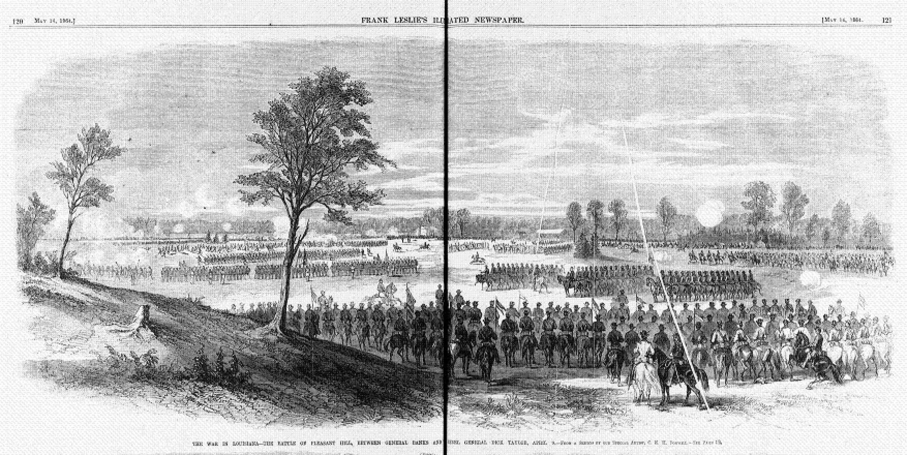
The Battle of Pleasant Hill can be considered as day two of the Battle of Mansfield, or Sabine Cross Roads. Due to the single, narrow road available for advance the Union Army, consisting of infantry, cavalry and supply and medical wagons, was strung out over many miles. A.J. Smith's Division of the 16th Corps, of which the 32nd Iowa Infantry Regiment was part of the Second Brigade under Col. W.T. Shaw, was assigned the last position in the column behind the rest of the army.
The head of the column ran into Confederate resistance south of Mansfield at Sabine Cross Roads on April 8th. About 4 p.m., after a couple hours of positioning and skirmishing, a Confederate assault was launched. The Federal line, outnumbered two-to-one due to the strung out nature of the column and order of march, soon collapsed into retreat. That retreat was turned into a near-rout when the retreating men collided with their own supply train. Finally, a rearguard action halted the Confederate pursuit. When darkness fell, Banks ordered the defeated army to regroup at Pleasant Hill.
On the night of April 8th, the 32nd Iowa went into camp near the town of Pleasant Hill, expecting to continue the march the following morning. They were about 20 miles behind the head of the column and only vaguely aware of the fight
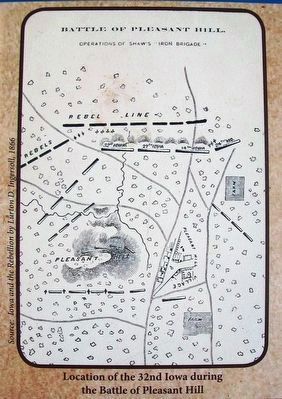
far from the front. During the night, thousands of terror-stricken men fleeing the disaster near Mansfield stampeded through the encampment. The division was put under arms just after midnight.At 10 a.m., the four regiments of Shaw's Brigade (including the 32nd Iowa) was ordered to the extreme front and placed at a right angle to the Mansfield Road about 1½ miles west of Pleasant Hill. The 32nd held the extreme left of the brigade. Two other Iowa regiments (the 27th and 14th) lined up beside it near the road and the 24th Missouri Infantry Regiment lined up north of the road. While the brigade held the center of the line, significant gaps on both sides left the unit somewhat isolated and greatly so after the battle began and supporting units on both sides of the brigade fell back.
The Confederate attack began about 5 p.m., concentrating against the center and Union left. The Federal forces on the left were flanked and they were forced to retreat. Soon the battle was in full force well behind Shaw's Brigade. The two Iowa regiments and the Missouri regiment were pulled back, but the order never reached Col. Scott, leaving the 32nd Iowa alone, soon surrounded, and fighting in three directions at once. For another two hours, the battle raged before rallying Union forces drove the Confederates back to their original line and the 32nd Iowa was among friendly forces again.
The
32nd entered the battle with 469 men able to carry a weapon. Col. Scott reported that he lost 210 men killed, wounded or missing in the battle.The evening, after the battle, General Banks held a war council and decided that retreat was the only option for the Federal forces. Interestingly, Confederate forces believed that they had been defeated by the Federals and they too began their retreat at daylight. Due to loss of wagons, medical supplies and previous orders to clear the roads in case a retreat was needed, all of the Union wounded were left behind and tended to by the residents of Pleasant Hill and some Union physicians who allowed themselves to be taken as prisoners of war by the Confederate forces. Those of the 32nd Iowa who died on the field of battle or of their wounds were buried in Mansfield, Pleasant Hill or near where they received care. Some of those individuals were later disinterred and reburied at the National Cemetery in Alexandria, Louisiana, many in unmarked graves. Other burial locations were never found and the final resting places remain unknown.
Total Forces
Union 25,000 • Confederate 11,000
Casualties
Union 3,980 • Confederate 3,976
Bibliography
Stuart, Addison A. Iowa Colonels and Regiments: Being a History of Iowa Regiments in the War of the Rebellion. Des Moines, Iowa: Mills and Company, 1865.
The Red River Campaign
As Clear Lake men who were part of Company B of the 32nd Iowa Volunteer Infantry moved south in their assigned duties, they became part of the ill-fated Red River Campaign in March and April of 1864. General Henry Halleck, the army's Chief-of-Staff, and President Lincoln wanted a campaign up the Red River with the primary target of Shreveport, the Confederate capital of Louisiana. Military, political and economic interests intertwined to make the campaign attractive. Shreveport was the center of the military-industrial complex for the Confederate Army West of the Mississippi River. It was on the major route for supplies coming from Mexico and a major cotton exporting point deep in the greatest cotton producing area in the Confederacy. Shreveport was a doorway for the occupation of Texas and a successful campaign would significantly aid in Lincoln's goal of repatriating both Louisiana and Texas. A Federal army here would also discourage interference from the French under Napoleon the 3rd in Mexico.
The plan was for a combined army and naval force under Major General Nathaniel P. Banks and Rear Admiral David D. Porter to advance northwest up the Red River from its mouth at the Mississippi to Shreveport, taking control of all fortifications and key points on the river. Unfortunately, the campaign was flawed from the beginning with multiple tactical
errors made on both sides. The Union advance got as far as Mansfield, about 40 miles south of Shreveport. There Confederate forces, under Major General Richard Taylor at the battles of Mansfield (aka Sabine Cross Roads) and Pleasant Hill, turned the Federal advance around and [U]nion forces had to fight their way back down river through hostile territory to the Mississippi.Topics and series. This historical marker is listed in this topic list: War, US Civil. In addition, it is included in the Former U.S. Presidents: #16 Abraham Lincoln series list. A significant day of the year for for this entry is April 8.
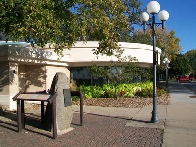
Location. 43° 8.135′ N, 93° 23.039′ W. Marker is in Clear Lake, Iowa, in Cerro Gordo County. Marker is on Lake View Drive north of Main Avenue, on the right when traveling north. Marker is west adjacent to the Lake View Community Room and Amphitheater in City Park. Touch for map. Marker is in this post office area: Clear Lake IA 50428, United States of America. Touch for directions.
Other nearby markers. At least 8 other markers are within walking distance of this marker. Civil War Memorial (here, next to this marker); Clear Lake in the Civil War (here, next to this marker); a different marker also named Clear Lake in the Civil War (here, next to this marker); Vietnam Veterans Memorial (about 300 feet away, measured in a direct line); Clear Lake Freedom Rock Veterans Memorial (approx. 0.3 miles away); Buddy Holly • Ritchie Valens • J. P. Richardson (approx. 0.4 miles away); Surf Ballroom (approx. 0.4 miles away); Three Stars Plaza (approx. half a mile away). Touch for a list and map of all markers in Clear Lake.
Also see . . . Battle of Pleasant Hill. Wikipedia entry (Submitted on September 1, 2023, by Larry Gertner of New York, New York.)
Credits. This page was last revised on September 1, 2023. It was originally submitted on October 10, 2015, by William Fischer, Jr. of Scranton, Pennsylvania. This page has been viewed 1,173 times since then and 84 times this year. Photos: 1. submitted on October 10, 2015, by William Fischer, Jr. of Scranton, Pennsylvania. 2. submitted on October 9, 2015, by William Fischer, Jr. of Scranton, Pennsylvania. 3. submitted on October 10, 2015, by William Fischer, Jr. of Scranton, Pennsylvania. 4. submitted on September 1, 2023, by Larry Gertner of New York, New York.


