Near Silver Springs in Lyon County, Nevada — The American Mountains (Southwest)
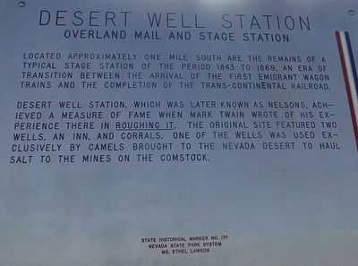
Desert Well Station
Overland Mail And Stage Station
Photographed by Trev Meed, circa 2014
1. Desert Well Station Marker
Desert Well Station, which was later known as Nelson's, achieved a measure of fame when Mark Twain wrote of his experience there in Roughing It. The original site featured two wells, an inn, and corrals. One of the wells was used exclusively by camels brought to the Nevada Desert to haul salt to the mines on the Comstock.
Erected by Nevada State Park System. Ms. Ethel Lawson. (Marker Number 177.)
Topics and series. This historical marker is listed in these topic lists: Communications • Notable Places. In addition, it is included in the Pony Express National Historic Trail series list. A significant historical year for this entry is 1843.
Location. 39° 21.846′ N, 119° 21.929′ W. Marker is near Silver Springs, Nevada, in Lyon County. It is at the intersection of Cheyenne Drrive and Lincoln Highway (U.S. 50), on the right when traveling south on Cheyenne Drrive. Touch for map. Marker
this page online

Regionally, this marker is in the Sierra Nevada and in Greater Reno Area. It is also in the American Mountain West. Globally, it is in North America, the Western Hemisphere, the Western World, and the Anglosphere. Historically, it finds itself in what was once New Spain and also Mexico’s Alta California.
Other nearby markers. At least 8 other markers are within 7 miles of this marker, measured as the crow flies: Stockton Well (approx. 5.4 miles away); Carson Trail - Susans Bluff Crossing (approx. 5½ miles away); Barracks and Mess Halls (approx. 7 miles away); Officers' Quarters (approx. 7 miles away); Commander's Office (approx. 7.1 miles away); Storehouses (approx. 7.1 miles away); Field Artillery (approx. 7.1 miles away); Post Cemetery (approx. 7.1 miles away). Touch for a list and map of all markers in Silver Springs.
Photographed by Paulette Nelson, December 13, 2019
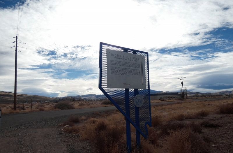
2. Desert Well Station Marker
Credits. This page was last revised on December 19, 2019. It was originally submitted on October 10, 2015, by Trev Meed of Round Mountain, Nevada. This page has been viewed 1,351 times since then and 74 times this year. Photos: 1. submitted on October 10, 2015, by Trev Meed of Round Mountain, Nevada. 2. submitted on December 17, 2019, by Paulette Nelson of N Las Vegas, Nevada. • Syd Whittle was the editor who published this page.
Editor’s want-list for this marker. Photo of the remains of the station as mentioned in marker text. • Can you help?
