Near Buford in Albany County, Wyoming — The American West (Mountains)
The Transcontinental Railroad

Photographed By Barry Swackhamer, September 8, 2015
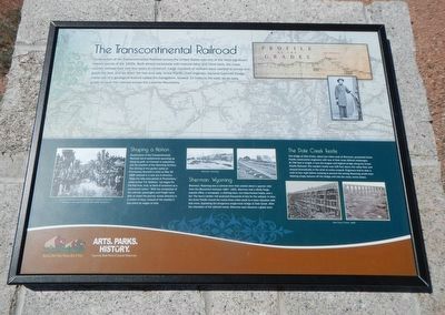
1. The Transcontinental Railroad Marker
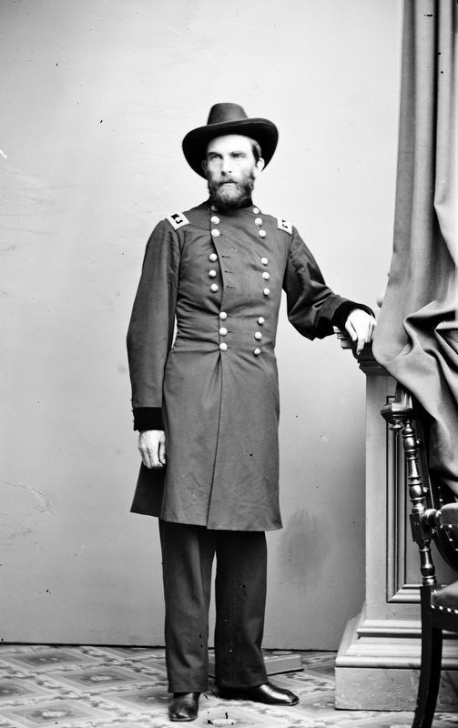
Captions: (top) Profile of the grades; General Grenville Dodge; (background) map of the Union Pacific Railroad across Wyoming; (bottom, left to right) General Grenville Dodge (center right) shakes hands with Samuel S. Montague at the Golden Spike Ceremony.; Sherman, Wyoming (2 photos); Dale Creek Trestle, 1868 (two photos).
Shaping a Nation
Construction of the Transcontinental Railroad led to settlements sprouting up along its path, an increase in population, and the creation of the Wyoming Territory. The driving of the golden spike at Promontory Summit in Utah on May 10, 1869 ushered in a new era of America. "Once the rails were joined at Promontory," wrote author T.H. Watkins, "we began for the first time, truly, to think of ourselves as a continental nation." With the completion of the railroad, passengers and freight wee able to make the journey across America in a matter of days, instead of months it had taken by wagon or ship.
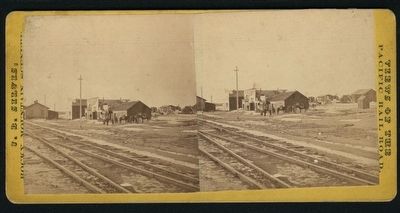
Sherman, Wyoming
Sherman, Wyoming was a railroad town that existed about a quarter mile from the Monument between 1867-1901. Sherman had a Wells Fargo express office, a newspaper, a clothing store, two false-fronted hotels, and a bar. The town's timber mill produced thousands of ties for the railroad. In time the Union Pacific moved the tracks three miles south to a lower the elevation with less snow, bypassing the dangerous single-track bridge at Dale Creek. With the relocation of the railroad tracks, Sherman soon became a ghost town.
The Dale Creek Trestle
The bridge at Dale Creek, about two miles west of Sherman, presented Union Pacific construction engineers with one of their most difficult challenges. At 706 feet in length, it was the longest and highest bridge along the Union Pacific Railroad. The wooden trestle was 125 feet above the valley floor and swayed dramatically in the wind as trains crossed. Engineers had to slow a train to four mph before crossing to prevent the strong Wyoming winds from blowing empty boxcars off the bridge and into the rocky ravine below.
Erected by Wyoming State Parks and Cultural Resources.
Topics and series. This historical marker is listed in this topic list: Railroads & Streetcars. In addition, it is included in the Transcontinental Railroad series list.
Location. 41° 7.859′ N, 105° 23.875′ W. Marker
is near Buford, Wyoming, in Albany County. Marker is on Monument Road near Hermosa Road, on the right when traveling south. Touch for map. Marker is at or near this postal address: 200 Monument Road, Buford WY 82052, United States of America. Touch for directions.
Other nearby markers. At least 8 other markers are within 8 miles of this marker, measured as the crow flies. Ames Monument (here, next to this marker); Pyramid on the Plains (here, next to this marker); Old Sherman Cemetery (approx. 0.3 miles away); Lonetree on the Laramie Range (approx. 2.7 miles away); Tree in the Rock (approx. 2.7 miles away); Tree Rock (approx. 2.7 miles away); Sherman Mountains (approx. 2.7 miles away); The Purple Heart Trail (approx. 7.6 miles away). Touch for a list and map of all markers in Buford.
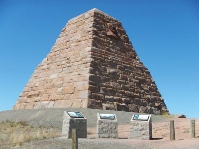
More about this marker. This marker is at the Ames Monument.
Also see . . . Sherman, part II - Wyoming Tale and Trails. Within 15 months of the railroad reaching Sherman Hill, the town boasted railroad machine shops, a Wells Fargo express office, a newspaper, a millinery store and, as indicated by the photo to the right, 2 two-story false fronted hotels, the Sherman House and the Summit House. They were not much as hotels but featured decent meals. Next door to the hotels was a bar. (Submitted on October 15, 2015, by Barry Swackhamer of Brentwood, California.)
Credits. This page was last revised on May 29, 2019. It was originally submitted on October 15, 2015, by Barry Swackhamer of Brentwood, California. This page has been viewed 830 times since then and 64 times this year. Photos: 1, 2, 3. submitted on October 15, 2015, by Barry Swackhamer of Brentwood, California. 4. submitted on May 27, 2019, by Allen C. Browne of Silver Spring, Maryland.


