
Sinclair in Carbon County, Wyoming — The American West (Mountains)
Civil War Cannons
Photographed by Barry Swackhamer, September 9, 2015
1. Civil War Cannons Marker
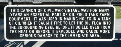
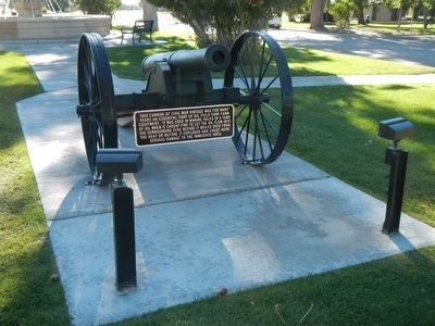
This cannon of Civil War vintage was for many years an essential part of oil field tank farm equipment. It was used in making holes in a tank of oil when it caught fire to let the oil flow into the surrounding dyke before it boiled over from the heat or before it exploded and caused more serious damage to the immediate area.
Topics. This historical marker is listed in this topic list: Industry & Commerce.
Location. 41° 46.746′ N, 107° 6.912′ W. Marker is in Sinclair, Wyoming, in Carbon County. It is on Lincoln Avenue (State Highway 76) near 6th Street, in the median. Touch for map. Marker is at or near this postal address: 498 Lincoln Avenue, Sinclair WY 82334, United States of America. Touch for directions.

Regionally, this marker is in Wyoming’s Westward Expansion Trails Region. It is also in the American Mountain West. Globally, it is in North America, the Rocky Mountains, the Western Hemisphere, the Western World, and the Anglosphere. Historically, it finds
this page online
Other nearby markers. At least 8 other markers are within 9 miles of this marker, measured as the crow flies: The Parco Inn (a few steps from this marker); Rawlins (approx. 6½ miles away); William Daley Flagpole (approx. 6½ miles away); Wyoming State Penitentiary (approx. 6.6 miles away); Rawlins Springs (approx. 6.7 miles away); Rawlins Paint Mines (approx. 6.7 miles away); Northern Boundary of The Republic of Texas (approx. 6.9 miles away); Early Construction (approx. 8½ miles away). Touch for a list and map of all markers in Sinclair.
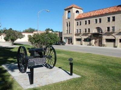
More about this marker. The cannon are located opposite the Parco Inn.
Photographed by Barry Swackhamer, September 9, 2015
2. Civil War Cannons Marker
Photographed by Barry Swackhamer, September 9, 2015
3. The other Civil War Cannon located in front of the Parco Inn
Credits. This page was last revised on June 16, 2016. It was originally submitted on October 18, 2015, by Barry Swackhamer of Brentwood, California. This page has been viewed 863 times since then and 91 times this year. Photos: 1, 2, 3. submitted on October 18, 2015, by Barry Swackhamer of Brentwood, California.
