National Park in Gloucester County, New Jersey — The American Northeast (Mid-Atlantic)
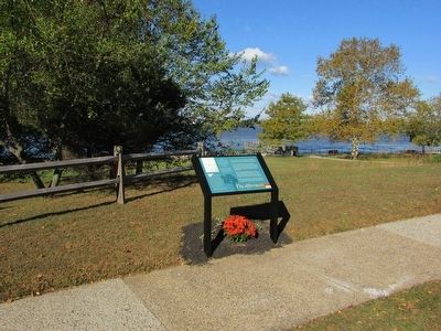
The Aftermath
Red Bank Battlefield
Photographed by Bill Coughlin, October 18, 2015
1. The Aftermath Marker
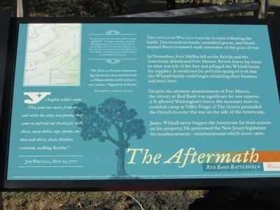
“Ye English soldiers came . . . They took two mares from me . . . and while the army was passing they came in and took our bread, pie, milk, cheese, meat dishes, cups, spoons, and then took shirts, sheets, blankets, coverleds, stodking, breeches. . . . ”
“The Forts at Province Island and Red Bank have been defended with a Magnanimity, which will give our Country a Reputation in Europe.”
The once lush Whitall farm lay in ruins following the battle. Decimated orchards, unmarked graves, and blood-stained floors remained stark reminders of the price of war.
In November, Fort Mifflin fell to the British and the Americans abandoned Fort Mercer. British forces lay waste to what was left of the fort and pillaged the Whitall home for supplies. It would not be until the spring of 1778 that the Whitall family could begin rebuilding their business and their lives.
Despite the ultimate abandonment of Fort Mercer, the victory at Red Bank was significant for two reasons: 1) It allowed Washington’s forces the necessary time to establish camp at Valley Forge; 2) The
this page online
James Whitall never forgave the Americans for their actions on his property. He petitioned the New Jersey legislature for reimbursement – reimbursement which never came.
Erected 2015 by New Jersey Historical Commission.
Topics and series. This historical marker is listed in this topic list: War, US Revolutionary. In addition, it is included in the Former U.S. Presidents: #02 John Adams series list.
Location. 39° 52.19′ N, 75° 11.432′ W. Marker is in National Park, New Jersey, in Gloucester County. It can be reached from Hessian Road, on the right when traveling west. Marker is on the Red Bank Battlefield. Touch for map. Marker is in this post office area: National Park NJ 08063, United States of America. Touch for directions.

Regionally, this marker is in South Jersey and in Greater Philadelphia. It is also in the American Northeast, in the Mid-Atlantic, and on the Eastern Seaboard. Globally, it is in the North Atlantic Region, North America, the Western Hemisphere, the Western World, and
Photographed by Bill Coughlin, October 18, 2015
2. The Aftermath Marker
Other nearby markers. At least 8 other markers are within walking distance of this marker: Whitall House (within shouting distance of this marker); Welcome to Red Bank Battlefield Park! (within shouting distance of this marker); Ann Cooper Whitall (within shouting distance of this marker); The Medicinal Garden (within shouting distance of this marker); James and Ann Whitall House (within shouting distance of this marker); Operations on the Delaware (within shouting distance of this marker); National Park Armed Service Monument (within shouting distance of this marker); The Naval Engagement (about 400 feet away, measured in a direct line). Touch for a list and map of all markers in National Park.
More about this marker. A map of the Plan of attack on the Fort of Red Bank appears at the upper left of the marker. It includes a caption of “This map shows how close the Whitall plantation was to two forts: Mercer and Mifflin. After the Hessians failed to take Fort Mercer, the crown turned its attention
Photographed by Bill Coughlin, October 18, 2015
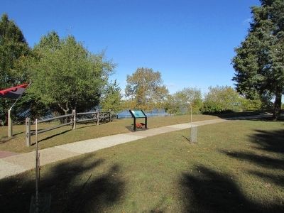
3. Marker on the Red Bank Battlefield
Photographed by Bill Coughlin, October 27, 2013
4. Inside the Whitall House
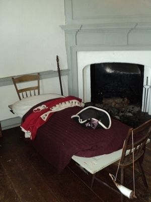
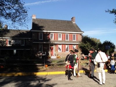
After the battle, the injured men, mostly Hessians, were carried to the Whithall House, which served as a field hospital for several weeks.
Photographed by Bill Coughlin, October 18, 2015
5. Whitall House
Credits. This page was last revised on June 16, 2016. It was originally submitted on October 19, 2015, by Bill Coughlin of Woodland Park, New Jersey. This page has been viewed 508 times since then and 21 times this year. Photos: 1, 2, 3, 4, 5. submitted on October 19, 2015, by Bill Coughlin of Woodland Park, New Jersey.
