
Near Bandy in Tazewell County, Virginia — The American South (Mid-Atlantic)
Mathias Harman, Sr.
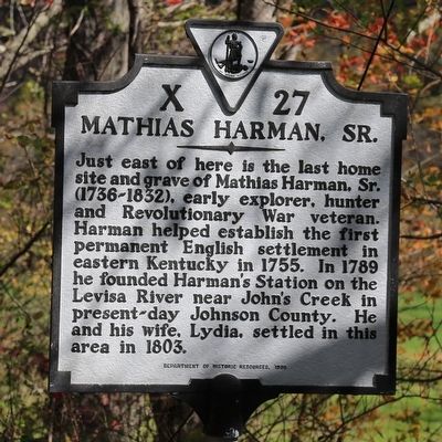
Photographed by J. J. Prats, October 16, 2015
1. Mathias Harman, Sr. Marker
Erected 1990 by Department of Historic Resources. (Marker Number X-27.)
Topics and series. This historical marker is listed in this topic list: Settlements & Settlers. In addition, it is included in the Virginia Department of Historic Resources (DHR) series list. A significant historical year for this entry is 1803.
Location. 37° 9.979′ N, 81° 37.794′ W. Marker is near Bandy, Virginia, in Tazewell County. It is on Route 637 5 miles north of County Route 631, on the right when traveling north. Touch for map. Marker is in this post office area: Bandy VA 24602, United States of America. Touch for directions.

Regionally, this marker is in Southwest Virginia. It is also in the American South, specifically in the Upper South, in
this page online
Other nearby markers. At least 8 other markers are within 5 miles of this marker, measured as the crow flies: Civilian Conservation Corps Company 1392 (approx. 0.9 miles away); Roark’s Gap Incident (approx. 2.6 miles away); Pisgah United Methodist Church (approx. 4.4 miles away); Thomas Whitten (approx. 4.4 miles away); Fincastle Turnpike (approx. 4.4 miles away); 250th Anniversary of the United States of America (approx. 4½ miles away); Big Crab Orchard or Witten’s Fort (approx. 4½ miles away); Fort Witten (approx. 4½ miles away).
Other markers no longer nearby. Pisgah United Methodist Church (was approx. 4.4 miles away but has been replaced with another marker now near it); Big Crab Orchard Or Witten’s Fort (was approx. 4½ miles away but has been replaced with another
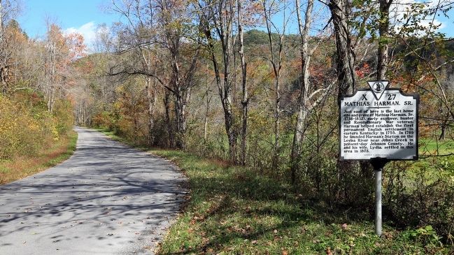
Photographed by J. J. Prats, October 16, 2015
2. Mathias Harman, Sr. Marker
Credits. This page was last revised on June 16, 2016. It was originally submitted on October 19, 2015, by J. J. Prats of Powell, Ohio. This page has been viewed 1,915 times since then and 120 times this year. Photos: 1, 2. submitted on October 19, 2015, by J. J. Prats of Powell, Ohio.
Editor’s want-list for this marker. Photo of the gravesite • Photo of the home site, if it is still visible • Can you help?
