Near Sinclair in Carbon County, Wyoming — The American West (Mountains)
Brownsville and Benton
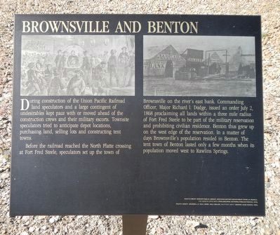
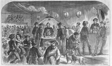
Before the railroad reached the North Platte crossing at Fort Fred Steele, speculators set up the town of Brownsville on the river's east bank. Commanding Officer, Major Richard I. Dodge, issued an order July 2, 1868 proclaiming all lands within a three mile radius of Fort Fred Steele to be part of the military reservation and prohibiting civilian residence. Benton thus grew up on the west edge of the reservation. In a matter of days Brownsville's population resided in Benton. The tent town of Benton lasted only a few months when its population move west to Rawlins Springs.
Erected by Wyoming Recreation Commission.
Topics and series. This historical marker is listed in these topic lists: Railroads & Streetcars • Settlements & Settlers. In addition, it is included in the Transcontinental Railroad series list. A significant historical date for this entry is July 2, 1868.
Location. 41° 46.619′ N, 106° 56.741′ W. Marker is near Sinclair, Wyoming, in Carbon County. Marker is on County Route 347 near Interstate 80, on the right when traveling north. Touch for map. Marker is in this post office area: Sinclair WY 82334, United States of America. Touch for directions.
Other nearby markers. At least 8 other markers are within walking distance of this marker. Railroad and River (here, next to this marker); Carbon Timber Company (here, next to this marker); A Well Traveled Sawmill (here, next to this marker); Town of Ft. Steele (here, next to this marker); Bridge Tender's House (a few steps from this marker); Image of Fort Fred Steele (about 300 feet away, measured in a direct line); Rock Springs Massacre (about 300 feet away); Major Thomas Tipton Thornburgh (about 300 feet away). Touch for a list and map of all markers in Sinclair.
More about this marker. The marker is located on County Road 347, north of the Interstate 80 Exit 228 and on the south side of the railroad tracks near where County Road 347 passes beneath the railroad bridge.
Also see . . . Building the Pacific Railroad: Hell on Wheels - Wyoming Tales and Trails. ... as the Union Pacific moved west there were also created instant boom towns at the end of the line serving the grading crews and providing a "jumping off" spot for those heading further west. The instant towns were filled with lawless elements.... The lawless elements were brought under control by the actions of Committees of Vigilence.... A few of these instant towns... consisted little more than tents and a few shanties in which saloon keepers, gamblers, and soiled doves plied their respective trades, may have lasted only a matter of months. (Submitted on October 20, 2015, by Barry Swackhamer of Brentwood, California.)
Credits. This page was last revised on June 16, 2016. It was originally submitted on October 20, 2015, by Barry Swackhamer of Brentwood, California. This page has been viewed 498 times since then and 13 times this year. Photos: 1, 2, 3. submitted on October 20, 2015, by Barry Swackhamer of Brentwood, California.


