Greenville in Washington County, Mississippi — The American South (East South Central)
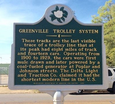
Greenville Trolley System
Photographed by Mark Hilton, October 17, 2015
1. Greenville Trolley System Marker
Erected 2003 by Mississippi Department of Archives and History.
Topics and series. This historical marker is listed in this topic list: Railroads & Streetcars. In addition, it is included in the Mississippi State Historical Marker Program series list. A significant historical year for this entry is 1900.
Location. 33° 24.622′ N, 91° 3.833′ W. Marker is in Greenville, Mississippi, in Washington County. It is on South Poplar Street 0.1 miles north of Central Street, on the right when traveling north. Touch for map. Marker is at or near this postal address: 215 South Poplar Street, Greenville MS 38701, United States of America. Touch for directions.

Regionally, this marker is in the American South, specifically in the Deep South, in the Mississippi Delta, and in the Great River Road
this page online
Other nearby markers. At least 8 other markers are within walking distance of this marker: First National Bank Building (about 300 feet away, measured in a direct line); Prince McCoy (about 400 feet away); Greenville's Writers (about 500 feet away); NRP Building (about 500 feet away); Where Main Street Meets the River (about 600 feet away); David "Honey Boy" Edwards (about 700 feet away); Charles K. Rickard (about 700 feet away); St. Joseph's Roman Catholic Church (about 700 feet away). Touch for a list and map of all markers in Greenville.
Also see . . . History of the Greenville Trolley System. (Submitted on October 21, 2015, by Mark Hilton of Montgomery, Alabama.)
Photographed by Mark Hilton, October 17, 2015
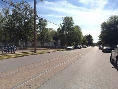
2. Nearby trolley system tracks (abandoned).
Photographed by Mark Hilton, October 17, 2015
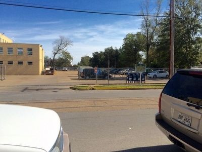
3. View of marker near Post Office parking area.
Credits. This page was last revised on June 16, 2016. It was originally submitted on October 21, 2015, by Mark Hilton of Montgomery, Alabama. This page has been viewed 954 times since then and 31 times this year. Photos: 1, 2, 3. submitted on October 21, 2015, by Mark Hilton of Montgomery, Alabama.
