
Near Sinclair in Carbon County, Wyoming — The American West (Mountains)
Town of Ft. Steele
Boom and Bust
| — | 1889 to 1940's | — |
Photographed by Barry Swackhamer, September 9, 2015
1. Town of Ft. Steele Marker
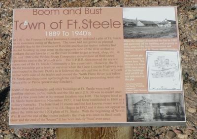
Captions: (top & center right) When the military abandoned the fort in 1889 and cautioned off the buildings and property in 1892 some of the local businessmen and ranchers hoped that Ft. Steele would remain a town. The earliest plat for the township is shown here. We believe it is from 1896 since some of the buildings sold in 1892 are not indicated on the plat.; (bottom right) Aero Filling Station, Fort Steele, Wyoming.
Some of the old barracks and other buildings at Ft. Steele were used as gasoline stations, cafes, motels and the like until U.S. 30 was re-routed and paved a few years later at its present location near
this page online
Topics and series. This historical marker is listed in this topic list: Settlements & Settlers. In addition, it is included in the First Transcontinental Railroad series list.
Location. 41° 46.621′ N, 106° 56.737′ W. Marker is near Sinclair, Wyoming, in Carbon County. It can be reached from County Route 374 near Interstate 80. Touch for map. Marker is in this post office area: Sinclair WY 82334, United States of America. Touch for directions.

Regionally, this marker is in Wyoming’s Westward Expansion Trails Region. It is also in the American Mountain West. Globally, it is in North America, the Rocky
Photographed by Barry Swackhamer, September 9, 2015
2. Town of Ft. Steele Marker
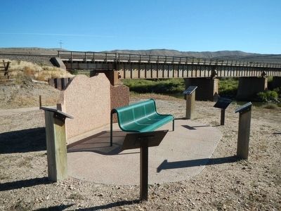
Other nearby markers. At least 8 other markers are within walking distance of this marker: A Well Traveled Sawmill (here, next to this marker); Carbon Timber Company (here, next to this marker); Brownsville and Benton (here, next to this marker); Railroad and River (here, next to this marker); Bridge Tender's House (a few steps from this marker); Image of Fort Fred Steele (about 300 feet away, measured in a direct line); Rock Springs Massacre (about 300 feet away); Major Thomas Tipton Thornburgh (about 300 feet away). Touch for a list and map of all markers in Sinclair.
More about this marker. This marker, among a grouping of a half-dozen other markers, is located at Fort Fred Steele State Park on County Road 347, north of the Interstate 80 Exit 228 and on the south side of the railroad tracks near where County Road 347 passes beneath the railroad bridge.
Credits. This page was last revised on June 16, 2016. It was originally submitted on October 21, 2015, by Barry Swackhamer of Brentwood, California. This page has been viewed 589 times since then and 25 times this year. Photos: 1, 2. submitted on October 21, 2015, by Barry Swackhamer of Brentwood, California.
