Derry Township in Washingtonville in Montour County, Pennsylvania — The American Northeast (Mid-Atlantic)
Washingtonville Bridge
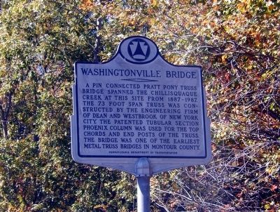
Photographed by Don Morfe, October 11, 2015
1. Washingtonville Bridge Marker
Erected by Pennsylvania Department of Transportation.
Topics. This historical marker is listed in this topic list: Bridges & Viaducts.
Location. 41° 3.419′ N, 76° 40.768′ W. Marker is in Washingtonville, Pennsylvania, in Montour County. It is in Derry Township. It is on Bush Road. Touch for map. Marker is at or near this postal address: 19 Bush Rd, Danville PA 17821, United States of America. Touch for directions.

Regionally, this marker is in the Susquehanna Valley. It is also in the American Northeast, in the Mid-Atlantic, in Appalachia, and specifically in Northern Appalachia. Globally, it is in North America, the Western Hemisphere, the Western World, and the Anglosphere. Historically,
this page online
Other nearby markers. At least 8 other markers are within 7 miles of this marker, measured as the crow flies: Fort Bosley (approx. 0.6 miles away); Christopher Sholes (approx. 5 miles away); World War II Watchtower (approx. 5 miles away); Mooresburg (approx. 5 miles away); a different marker also named Mooresburg (approx. 5 miles away); Mooresburg Schoolhouse (approx. 5 miles away); a different marker also named Christopher Sholes (approx. 5.1 miles away); Chillisquaque Presbyterian Church Cemetery (approx. 6.8 miles away).
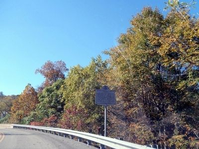
Photographed by Don Morfe, October 11, 2015
2. Washingtonville Bridge Marker
Credits. This page was last revised on October 21, 2024. It was originally submitted on October 22, 2015, by Don Morfe of Baltimore, Maryland. This page has been viewed 454 times since then and 21 times this year. Photos: 1, 2. submitted on October 22, 2015, by Don Morfe of Baltimore, Maryland. • Bill Pfingsten was the editor who published this page.
