
Near Sinclair in Carbon County, Wyoming — The American West (Mountains)
The Passenger's Railroad
The Union Pacific Line
Photographed by Barry Swackhamer, September 9, 2015
1. The Passenger's Railroad Marker
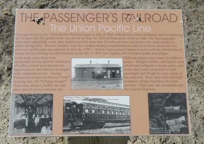
Captions: (center) Fred Steele Rail Road Depot; (bottom left) Dining Car; (bottom middle) Pullman's Palace Sleeper; (bottom right) Sleeping Car.
In the early years there were occasional wrecks until the intricacies of traffic control were figured out. Improvements and innovations began with continental travel. George Pullman developed his famous "hotel" sleeping cars, the "Pullman Sleeper". Then came dinners (sic), buffet cars and other special railroad cars.
Different engines were made for different grades. Bridges, trestles and tunnels were rebuilt and realigned to ensure safety, and feeder
this page online
Erected by Wyoming Recreation Commission.
Topics and series. This historical marker is listed in this topic list: Railroads & Streetcars. In addition, it is included in the First Transcontinental Railroad series list.
Location. 41° 46.701′ N, 106° 56.869′ W. Marker is near Sinclair, Wyoming, in Carbon County. It is on County Route 347 near Interstate 80, on the right when traveling west. Touch for map. Marker is in this post office area: Sinclair WY 82334, United States of America. Touch for directions.

Regionally, this marker is in Wyoming’s Westward Expansion Trails Region. It is also in the American Mountain West. Globally, it is in North America, the Rocky Mountains, the Western Hemisphere, the Western World, and the Anglosphere. Historically, it finds itself in what was once the Republic of Texas.
Other nearby markers. At least 8 other markers are
Photographed by Barry Swackhamer, September 9, 2015
2. The Passenger's Railroad Marker
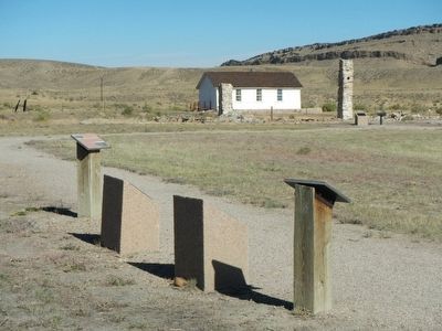
This marker is closest to the viewer.
More about this marker. This marker, among a grouping of a four other markers, is located at Fort Fred Steele State Historic Site. The site is on County Road 347, north of the Interstate 80 Exit 228 and on the north side of the railroad tracks.

Photographed by Lithograph, circa 1876
3. Early Pullman Sleeping Cars
Credits. This page was last revised on September 18, 2020. It was originally submitted on October 24, 2015, by Barry Swackhamer of Brentwood, California. This page has been viewed 470 times since then and 25 times this year. Photos: 1, 2, 3. submitted on October 24, 2015, by Barry Swackhamer of Brentwood, California.
