Hinesville in Liberty County, Georgia — The American South (South Atlantic)
Hinesville Methodist Church
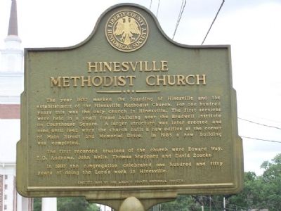
Photographed by Mike Stroud, July 2008
1. Hinesville Methodist Church Marker
The first recorded trustees of the church were Edward Way, E.O. Andrews, John Wells, Thomas Sheppard and David Zoucks.
In 1987 the congregation celebrated one hundred and fifty years of doing the Lord`s work in Hinesville.
Erected 1998 by The Liberty County Historical Society.
Topics. This historical marker is listed in this topic list: Religion & Religious Structures. A significant historical year for this entry is 1837.
Location. 31° 50.938′ N, 81° 35.761′ W. Marker is in Hinesville, Georgia, in Liberty County. It is at the intersection of North Main Street and Memorial Drive, on the right when traveling west on North Main Street. Located at the church 1 block north
this page online

Regionally, this marker is on the Coastal Plain and on the Georgia Coast and the Golden Isles. It is also in the American South, specifically in the Deep South, and on the Eastern Seaboard. Globally, it is in the North Atlantic Region, North America, the Western Hemisphere, the Western World, and the Anglosphere. Historically, it finds itself in what was once New Spain, the territory of the Mississippian Culture, one of the original Thirteen Colonies, one of the Confederate States of America, and the Antebellum South.
Other nearby markers. At least 8 other markers are within walking distance of this marker: Fort Morris Cannon (about 400 feet away, measured in a direct line); Charlton Hines House (about 500 feet away); Liberty County (about 500 feet away); Liberty County Confederate Monument (about 500 feet away); Bradwell Park (about 600 feet away); The Bacon-Fraser House (approx. 0.2 miles away); Old Liberty County Jail (approx. ¼ mile away); Bradwell Institute (approx.
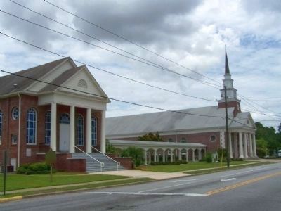
Photographed by Mike Stroud, 2008
2. Hinesville Methodist Church
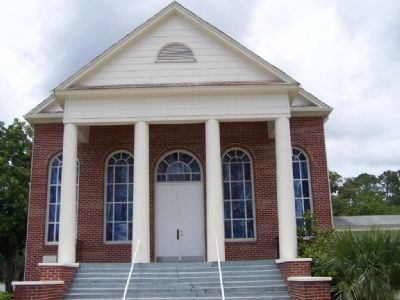
Photographed by Mike Stroud, 2008
3. Hinesville Methodist Church
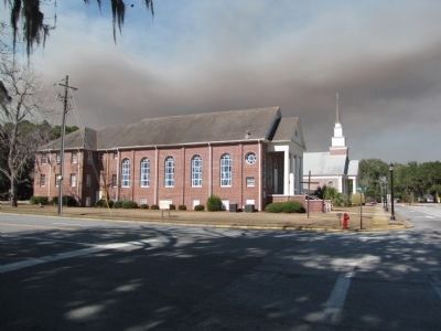
Photographed by Lee Hattabaugh, February 18, 2011
4. Hinesville Methodist Church Marker
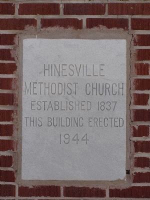
Photographed by Lee Hattabaugh, February 18, 2011
5. Hinesville Methodist Church Marker
Located to the left of the front steps of the older church building.
Credits. This page was last revised on October 21, 2020. It was originally submitted on July 8, 2008, by Mike Stroud of Bluffton, South Carolina. This page has been viewed 1,910 times since then and 41 times this year. Photos: 1, 2, 3. submitted on July 8, 2008, by Mike Stroud of Bluffton, South Carolina. 4, 5. submitted on April 12, 2011, by Lee Hattabaugh of Capshaw, Alabama. • Craig Swain was the editor who published this page.
