Near Sinclair in Carbon County, Wyoming — The American West (Mountains)
Sheep Ranching
The Sheep Wagon
Photographed by Barry Swackhamer, September 9, 2015
1. Sheep Ranching Marker
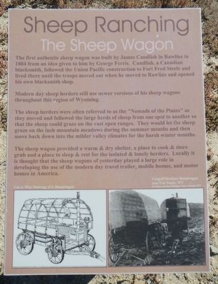
Captions: (bottom left) Cut-A-Way Drawing of A Sheepwagon; (bottom right) Coggriff Brothers Sheepwagons near Fort Steele, WY.
Modern day sheep herders still use newer versions of his sheep wagons throughout this region of Wyoming.
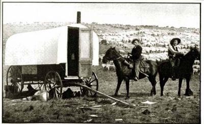
The sheep herders were often referred to as the "Nomads of the Plains" as they moved and followed the large herds of sheep from one spot to another so that the sheep could graze on the vast open ranges. They would let the sheep graze on lush mountain meadows during the summer months and then move back down to the milder valley climates for the harsh winter months.
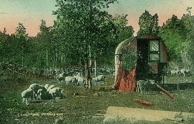
The sheep wagon provided a warm and dry shelter, a place to cook & store grub and a place to sleep & rest for the isolated & lonely herders. Locally it is though that the sheep wagon of yesterday played a large roll in developing the use of the modern day travel trailer, mobile homes, and motor homes in America.
Erected by Wyoming Recreation
this page online
Topics. This historical marker is listed in this topic list: Industry & Commerce.
Location. 41° 46.568′ N, 106° 56.797′ W. Marker is near Sinclair, Wyoming, in Carbon County. It is on County Route 347 near Interstate 80, on the right when traveling north. Touch for map. Marker is in this post office area: Sinclair WY 82334, United States of America. Touch for directions.

Regionally, this marker is in the Westward Expansion Trails Region. It is also in the American Mountain West. Globally, it is in North America, the Rocky Mountains, the Western Hemisphere, the Western World, and the Anglosphere. Historically, it finds itself in what was once the Republic of Texas.
Other nearby markers. At least 8 other markers are within walking distance of this marker: Sheep Industry (here, next to this marker); Ranching (a few steps from this marker); Sheepherder's Community (a few steps from this marker); Bridge Tender's House (about 400 feet away, measured in a direct line); Railroad and River (about 400 feet away); Brownsville and Benton (about 400 feet away); Carbon Timber Company
Photographed by Barry Swackhamer, September 9, 2015
2. Sheep Ranching Marker
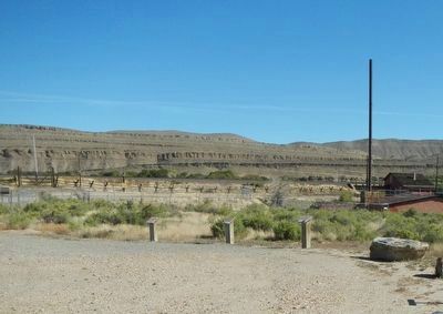
This marker is on the right.
More about this marker. This marker, among a grouping of a four markers, is located at Fort Fred Steele State Historic Site. The markers are on County Road 347, north of the Interstate 80 Exit 228 and just south of the railroad tracks.
Photographed by Unknown
3. Sheep Camp
Photographed by Unknown
4. Sheepherders
Credits. This page was last revised on June 16, 2016. It was originally submitted on October 26, 2015, by Barry Swackhamer of Brentwood, California. This page has been viewed 860 times since then and 30 times this year. Photos: 1, 2, 3, 4. submitted on October 26, 2015, by Barry Swackhamer of Brentwood, California.
