Maitland in Leeds and Grenville United Counties, Ontario — Central Canada (North America)
The Founding of Maitland
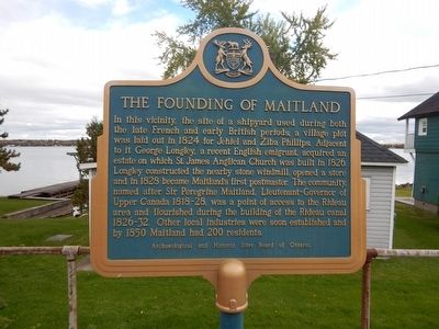
Photographed by Kevin Craft, October 14, 2015
1. The Founding of Maitland Marker
Erected by Archaeological and Historic Sites Board of Ontario.
Topics and series. This historical marker is listed in this topic list: Settlements & Settlers. In addition, it is included in the Canada, Ontario Heritage Trust, and the Windmills series lists. A significant historical year for this entry is 1824.
Location. 44° 38.137′ N, 75° 36.739′ W. Marker is in Maitland, Ontario, in Leeds and Grenville United Counties. It is on Provincial
this page online

Regionally, this marker is in Eastern Ontario and specifically in Southeastern Ontario. It is also in Central Canada. Globally, it is in North America, the Western Hemisphere, the Western World, and the Anglosphere. Historically, it finds itself in what was once a British colony, the Viceroyalty of New France, the Haudenosaunee (Iroquois) Confederacy, and Rupert’s Land.
Other nearby markers. At least 8 other markers are within 3 kilometers of this marker, measured as the crow flies: Dumbrille's Store (a few steps from this marker); Lieut.-Col. Thain Wendell MacDowell, V.C., D.S.O. (within shouting distance of this marker); Dorothy Martha Dumbrille (within shouting distance of this marker); Douglas Rupert Dumbrille (within shouting distance of this marker); St. James's Masonic Lodge No. 74 (about 180 meters away, measured in a direct line); Pointe Au Baril (approx. 0.3 kilometers away); St. James Church 1826 (approx. 0.3 kilometers away); War of 1812
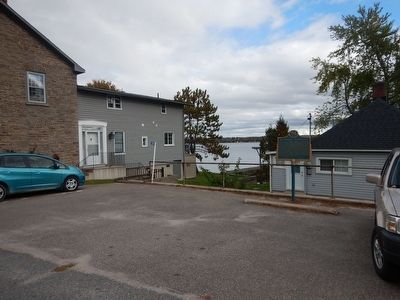
Photographed by Kevin Craft, October 14, 2015
2. Wideview of The Founding of Maitland Marker
Credits. This page was last revised on September 27, 2019. It was originally submitted on October 27, 2015, by Kevin Craft of Bedford, Quebec. This page has been viewed 976 times since then and 60 times this year. Photos: 1, 2. submitted on October 27, 2015, by Kevin Craft of Bedford, Quebec.
