East Irondequoit in Monroe County, New York — The American Northeast (Mid-Atlantic)
Swayne's Corners
Photographed by Anton Schwarzmueller, October 31, 2015
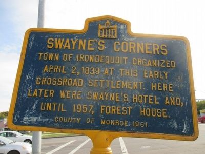
1. Swayne's Corners Marker
Town of Irondequoit organized
April 2, 1839 at his early
crossroad settlement. Here
later were Swayne's Hotel and,
until 1957, Forest House.
Erected 1961 by County of Monroe.
Topics. This historical marker is listed in this topic list: Settlements & Settlers. A significant historical date for this entry is April 2, 1839.
Location. 43° 12.221′ N, 77° 33.7′ W. Marker is in Irondequoit, New York, in Monroe County. It is in East Irondequoit. It is at the intersection of East Ridge Road (County Route 241) and Culver Road (County Route 120), on the right when traveling west on East Ridge Road. Corner lot is currently occupied by a Walgreen's store. Touch for map. Marker is at or near this postal address: 2100 East Ridge Road, Rochester NY 14622, United States of America. Touch for directions.

Regionally, this marker is in Upstate New York, specifically in Western New York, in the Finger Lakes, and in the Rochester Metropolitan Area. It is also in the American Northeast and in the Mid-Atlantic. Globally, it is in North America, on the Great Lakes, in the Western Hemisphere, in the Western World, and in
this page online
Other nearby markers. At least 8 other markers are within 2 miles of this marker, measured as the crow flies: Irondequoit War Memorial (approx. 1.1 miles away); Pioneer Hooker Cemetery (approx. 1.2 miles away); Merchants Road (approx. 1.2 miles away); Pioneer Home (approx. 1.2 miles away); Cobblestone Blacksmith Shop (approx. 1.2 miles away); Here Stands one of the Oldest Pieces of Earth (approx. 1.2 miles away); Our Irondequoit (approx. 1.8 miles away); An Early Doctor (approx. 1.9 miles away). Touch for a list and map of all markers in Irondequoit.
Photographed by Anton Schwarzmueller, October 31, 2015
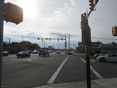
2. Westward
Intersection is very busy; difficult to shoot.
Photographed by Anton Schwarzmueller, October 31, 2015
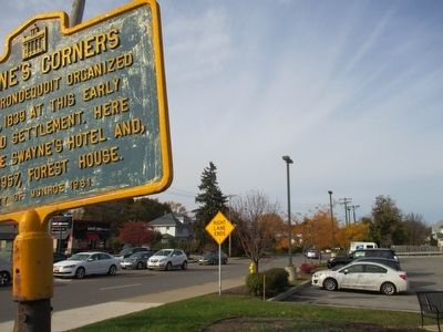
3. Northward
Culver Road. Marker is very close to the roadways; unable to back up for wider view.
Credits. This page was last revised on February 16, 2023. It was originally submitted on November 1, 2015, by Anton Schwarzmueller of Wilson, New York. This page has been viewed 813 times since then and 60 times this year. Photos: 1, 2, 3. submitted on November 1, 2015, by Anton Schwarzmueller of Wilson, New York.
