Independence in Jackson County, Missouri — The American Midwest (Upper Plains)
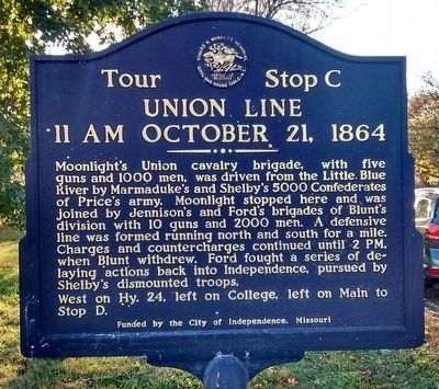
Union Line
11 AM October 21, 1864
— Tour Stop C —
West on Hy. 24, left on Collete, left on Main to Stop D.
Erected by City of Independence, Missouri.
Topics. This historical marker is listed in this topic list: War, US Civil. A significant historical date for this entry is October 21, 1864.
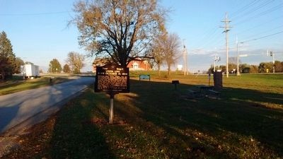
Location. 39° 8.092′ N, 94° 20.494′ W. Marker is in Independence, Missouri, in Jackson County. Marker is on East Old Lexington Road west of North Blue Mills Road, on the left when traveling west. Touch for map. Marker is in this post office area: Independence MO 64058, United States of America. Touch for directions.
Other nearby markers. At least 8 other markers are within 5 miles of this marker, measured as the crow flies. Santa Fe Trail (a few steps from this marker); Price's Great Missouri Raid (a few steps from this marker); Salem Cemetery Association (about 700 feet away, measured in a direct line); Engagement at the Little Blue (approx. 1.6 miles away); Trail of Death (approx. 3.2 miles away); Vaile Mansion (approx. 4.4 miles away); a different marker also named Trail of Death (approx. 4.7 miles away); Independence Pioneer Spring (approx. 4.7 miles away). Touch for a list and map of all markers in Independence.
Also see . . . Tour: Independence Historical Markers. (Submitted on November 7, 2015.)
Credits. This page was last revised on June 16, 2016. It was originally submitted on November 7, 2015, by Tom Bosse of Jefferson City, Tennessee. This page has been viewed 398 times since then and 22 times this year. Last updated on November 8, 2015, by Keith S Smith of West Chester, Pennsylvania. Photos: 1, 2. submitted on November 7, 2015, by Tom Bosse of Jefferson City, Tennessee. • Bernard Fisher was the editor who published this page.

